AppBrain
|
Apps
Apps
Apps being viewed right now
Trending apps today
Most popular apps
All-time most downloaded apps
Top rated apps
Statistics
Docs
Developers
Sign up
Log in
Android Apps
>
Maps & Navigation
>
Paid
Category
Maps & Navigation
Sort by
Trending
Recent downloads
All-time downloads
Top rated
Popular in
Filter by
Off
Free
Paid
New
Updated
Price Reduced
No ads
Page 8 of the
best Paid Maps & Navigation Apps for Android
Starry Starry Day Professional
Mapsoft
Starry Starry Day Pro allows the daytime use of a total station to rapidly obtain highly accurate True and Grid North azimuths to astro objects without needing an internet connection. Brief Usage In…
$0.49
0.0
10+ downloads
|
Maps & Navigation
0.0
$0.49
Mapsoft
10+ downloads
TRANSPORTATION
Starry Starry Day Professional
Starry Starry Day Pro allows the daytime use of a total station to rapidly obtain highly accurate True and Grid North a…
OBD Info-san!
ganchi
note: The text translates the original Japanese with a Google translation. [Operation check in the trial version! 】 Although this application is charged, there is a possibility that it will not oper…
$4.99
0.0
5,000+ downloads
|
Maps & Navigation
0.0
$4.99
ganchi
5,000+ downloads
TRANSPORTATION
OBD Info-san!
note: The text translates the original Japanese with a Google translation. [Operation check in the trial version! 】 Al…
Lake Seminole Offline Charts – Click to show
Lake Seminole Offline Charts
MAPITECH LTD
MapiTech launches on the market the best official up-to-date NOAA RNC (raster) combined with S57 nautical charts (digital): marinas, wrecks, fishing spots, boat ramps, POI. This app displays seamles…
$4.99
0.0
0+ downloads
|
Maps & Navigation
0.0
$4.99
MAPITECH LTD
0+ downloads
TRANSPORTATION
Lake Seminole Offline Charts
MapiTech launches on the market the best official up-to-date NOAA RNC (raster) combined with S57 nautical charts (digit…
Mallorca Menorca Offline Chart – Click to show
Mallorca Menorca Offline Chart
MAPITECH LTD
MapiTech launches on the market the best official up-to-date RNC (raster) combined with S57 nautical charts (digital): marinas, wrecks, fishing spots, boat ramps, POI. This app displays seamlessly …
$4.99
0.0
1+ downloads
|
Maps & Navigation
0.0
$4.99
MAPITECH LTD
1+ downloads
TRANSPORTATION
Mallorca Menorca Offline Chart
MapiTech launches on the market the best official up-to-date RNC (raster) combined with S57 nautical charts (digital):…
Lake Vanern GPS Fishing Charts – Click to show
Lake Vanern GPS Fishing Charts
FLYTOMAP INC
Flytomap is a valid and interesting alternative, Worldwide Marine and Outdoor Maps available when connected, thanks to viewer.flytomap.com Worldwide Satellite images overlay on charts Worldwide Ter…
$3.99
0.0
10+ downloads
|
Maps & Navigation
0.0
$3.99
FLYTOMAP INC
10+ downloads
TRANSPORTATION
Lake Vanern GPS Fishing Charts
Flytomap is a valid and interesting alternative, Worldwide Marine and Outdoor Maps available when connected, thanks to…
What Street?
Applorium Ltd
Welcome to What Street? – the ultimate street name identification app that tells you exactly where you are! Have you ever found yourself lost in a new city, wandering aimlessly down unfamiliar…
$1.99
0.0
100+ downloads
|
Maps & Navigation
0.0
$1.99
Applorium Ltd
100+ downloads
TRANSPORTATION
What Street?
Welcome to What Street? – the ultimate street name identification app that tells you exactly where you are! Have…
Helsinki GPS Map Navigator – Click to show
Helsinki GPS Map Navigator
FLYTOMAP INC
Flytomap is a valid and interesting alternative, Featured on the Deck Featured on Geomedia Worldwide Marine and Outdoor Maps available when connected, thanks to viewer.flytomap.com Worldwide Satelli…
$3.99
0.0
5+ downloads
|
Maps & Navigation
0.0
$3.99
FLYTOMAP INC
5+ downloads
TRANSPORTATION
Helsinki GPS Map Navigator
Flytomap is a valid and interesting alternative, Featured on the Deck Featured on Geomedia Worldwide Marine and Outdoo…
Lake of the Ozarks GPS Charts – Click to show
Lake of the Ozarks GPS Charts
FLYTOMAP INC
Flytomap is a valid and interesting alternative, Featured on the Deck Featured on Geomedia Worldwide Marine and Outdoor Maps available when connected, thanks to viewer.flytomap.com Worldwide Satelli…
$3.99
0.0
100+ downloads
|
Maps & Navigation
0.0
$3.99
FLYTOMAP INC
100+ downloads
TRANSPORTATION
Lake of the Ozarks GPS Charts
Flytomap is a valid and interesting alternative, Featured on the Deck Featured on Geomedia Worldwide Marine and Outdoo…
Mille Lacs Gps Map Navigator – Click to show
Mille Lacs Gps Map Navigator
FLYTOMAP INC
Flytomap is a valid and interesting alternative, Featured on the Deck Featured on Geomedia Worldwide Marine and Outdoor Maps available when connected, thanks to viewer.flytomap.com Worldwide Satelli…
$3.99
0.0
50+ downloads
|
Maps & Navigation
0.0
$3.99
FLYTOMAP INC
50+ downloads
TRANSPORTATION
Mille Lacs Gps Map Navigator
Flytomap is a valid and interesting alternative, Featured on the Deck Featured on Geomedia Worldwide Marine and Outdoo…
Percy Priest Lake Offline Maps – Click to show
Percy Priest Lake Offline Maps
MAPITECH LTD
MapiTech launches on the market the best official up-to-date NOAA RNC (raster) combined with S57 nautical charts (digital): marinas, wrecks, fishing spots, boat ramps, POI. This app displays seamles…
$4.99
0.0
1+ downloads
|
Maps & Navigation
0.0
$4.99
MAPITECH LTD
1+ downloads
TRANSPORTATION
Percy Priest Lake Offline Maps
MapiTech launches on the market the best official up-to-date NOAA RNC (raster) combined with S57 nautical charts (digit…
Speedometer
Mykola Drozd
Good and easy to use speedometer, pedometer, route tracker. Convenient for sports, fitness, hiking, traveling and other purposes when you need to know about your speed and location. Allows you to sa…
$1.49
0.0
50+ downloads
|
Maps & Navigation
0.0
$1.49
Mykola Drozd
50+ downloads
TRANSPORTATION
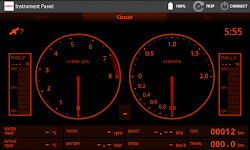
Speedometer
Good and easy to use speedometer, pedometer, route tracker. Convenient for sports, fitness, hiking, traveling and other…
Costa Brava GPS Map Navigator – Click to show
Costa Brava GPS Map Navigator
FLYTOMAP INC
Flytomap is a valid and interesting alternative, Featured on the Deck Featured on Geomedia Worldwide Marine and Outdoor Maps available when connected, thanks to viewer.flytomap.com Worldwide Satellit…
$3.99
0.0
5+ downloads
|
Maps & Navigation
0.0
$3.99
FLYTOMAP INC
5+ downloads
TRANSPORTATION
Costa Brava GPS Map Navigator
Flytomap is a valid and interesting alternative, Featured on the Deck Featured on Geomedia Worldwide Marine and Outdoor…
US Rivers GPS Map Navigator – Click to show
US Rivers GPS Map Navigator
FLYTOMAP INC
Flytomap is a valid and interesting alternative, Worldwide Marine and Outdoor Maps available when connected, thanks to viewer.flytomap.com Worldwide Satellite images overlay on charts Worldwide Terr…
$4.99
0.0
100+ downloads
|
Maps & Navigation
0.0
$4.99
FLYTOMAP INC
100+ downloads
TRANSPORTATION
US Rivers GPS Map Navigator
Flytomap is a valid and interesting alternative, Worldwide Marine and Outdoor Maps available when connected, thanks to …
Wisconsin Mushroom Forager Map – Click to show
Wisconsin Mushroom Forager Map
GeoPOI LLC
The forests and woodlands of Wisconsin and the Midwest are ecosystems rich with edible wild mushrooms if you know where to look. Trouble is, seasoned wild edible collectors seldom share their 'honey …
$1.49
0.0
1+ downloads
|
Maps & Navigation
0.0
$1.49
GeoPOI LLC
1+ downloads
TRANSPORTATION
Wisconsin Mushroom Forager Map
The forests and woodlands of Wisconsin and the Midwest are ecosystems rich with edible wild mushrooms if you know where…
Ceuta GPS Map Navigator – Click to show
Ceuta GPS Map Navigator
FLYTOMAP INC
Flytomap is a valid and interesting alternative, Featured on the Deck Featured on Geomedia Worldwide Marine and Outdoor Maps available when connected, thanks to viewer.flytomap.com Worldwide Satellit…
$3.99
0.0
5+ downloads
|
Maps & Navigation
0.0
$3.99
FLYTOMAP INC
5+ downloads
TRANSPORTATION
Ceuta GPS Map Navigator
Flytomap is a valid and interesting alternative, Featured on the Deck Featured on Geomedia Worldwide Marine and Outdoor…
PgW Navigation App
Aerotools
This application is a navigation assistant which provides useful information about all the airports and navaids located around you (40Nm range max). Directly on your watch, with your location informa…
$15.99
0.0
100+ downloads
|
Maps & Navigation
0.0
$15.99
Aerotools
100+ downloads
TRANSPORTATION
PgW Navigation App
This application is a navigation assistant which provides useful information about all the airports and navaids located…
Lake Joe Pool Texas GPS Charts – Click to show
Lake Joe Pool Texas GPS Charts
FLYTOMAP INC
Flytomap is a valid and interesting alternative, Featured on the Deck Featured on Geomedia Worldwide Marine and Outdoor Maps available when connected, thanks to viewer.flytomap.com Worldwide Satelli…
$3.99
0.0
5+ downloads
|
Maps & Navigation
0.0
$3.99
FLYTOMAP INC
5+ downloads
TRANSPORTATION
Lake Joe Pool Texas GPS Charts
Flytomap is a valid and interesting alternative, Featured on the Deck Featured on Geomedia Worldwide Marine and Outdoo…
Balaton Lake GPS Map Navigator – Click to show
Balaton Lake GPS Map Navigator
FLYTOMAP INC
Flytomap is a valid and interesting alternative, Worldwide Marine and Outdoor Maps available when connected, thanks to viewer.flytomap.com Worldwide Satellite images overlay on charts Worldwide Terr…
$3.99
0.0
100+ downloads
|
Maps & Navigation
0.0
$3.99
FLYTOMAP INC
100+ downloads
TRANSPORTATION
Balaton Lake GPS Map Navigator
Flytomap is a valid and interesting alternative, Worldwide Marine and Outdoor Maps available when connected, thanks to …
Lake Diamond Valley CA Offline – Click to show
Lake Diamond Valley CA Offline
FLYTOMAP INC
Flytomap is a valid and interesting alternative, Featured on the Deck Featured on Geomedia Worldwide Marine and Outdoor Maps available when connected, thanks to viewer.flytomap.com Worldwide Satelli…
$2.99
0.0
0+ downloads
|
Maps & Navigation
0.0
$2.99
FLYTOMAP INC
0+ downloads
TRANSPORTATION
Lake Diamond Valley CA Offline
Flytomap is a valid and interesting alternative, Featured on the Deck Featured on Geomedia Worldwide Marine and Outdoo…
Como Park Lake Zoo Map & Guide – Click to show
Como Park Lake Zoo Map & Guide
GeoPOI LLC
Como Park is one of the most visited destinations in Minnesota, and for good reason! Located in northwest Saint Paul in Ramsey County, Como Park was established in 1884 and has a rich history as an p…
$0.49
0.0
1+ downloads
|
Maps & Navigation
0.0
$0.49
GeoPOI LLC
1+ downloads
TRANSPORTATION
Como Park Lake Zoo Map & Guide
Como Park is one of the most visited destinations in Minnesota, and for good reason! Located in northwest Saint Paul in…
United States
United Kingdom
Germany
Norway
Sweden
Australia
Netherlands
Italy
Denmark
Hong Kong
Brazil
France
Canada
Spain
Portugal
South Korea
Japan
Poland
Hungary
India
Finland
Thailand
Russia
General
Overall
Applications
Games
Join AppBrain
Join AppBrain to get app recommendations
Apps
Art & Design
Auto & Vehicles
Beauty
Books & Reference
Business
Comics
Communication
Dating
Education
Entertainment
Events
Finance
Food & Drink
Health & Fitness
House & Home
Libraries & Demo
Lifestyle
Maps & Navigation
Medical
Music & Audio
News & Magazines
Parenting
Personalization
Photography
Productivity
Shopping
Social
Sports
Tools
Travel & Local
Video Players & Editors
Weather
Games
Action
Adventure
Arcade
Board
Card
Casino
Casual
Educational
Music
Puzzle
Racing
Role Playing
Simulation
Sports Games
Strategy
Trivia
Word