AppBrain
|
Apps
Apps
Apps being viewed right now
Trending apps today
Most popular apps
All-time most downloaded apps
Top rated apps
Statistics
Docs
Developers
Sign up
Log in
Android Apps
>
Maps & Navigation
>
Paid
Category
Maps & Navigation
Sort by
Trending
Recent downloads
All-time downloads
Top rated
Popular in
Filter by
Off
Free
Paid
New
Updated
Price Reduced
No ads
Page 9 of the
best Paid Maps & Navigation Apps for Android
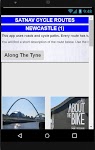
Satnav Cycle Routes-Newcastle1 – Click to show
Satnav Cycle Routes-Newcastle1
Ian Lochhead
1. Along the Tyne - 15 miles 2. Newcastle to Gateshead - 23.5 miles 3. Newcastle to Sunderland - 39 miles Satnav Cycle Routes around Newcastle using cycle paths and roads. Every route has turn-by-tu…
$0.99
0.0
0+ downloads
|
Maps & Navigation
0.0
$0.99
Ian Lochhead
0+ downloads
TRANSPORTATION
Satnav Cycle Routes-Newcastle1
1. Along the Tyne - 15 miles 2. Newcastle to Gateshead - 23.5 miles 3. Newcastle to Sunderland - 39 miles Satnav Cycle…
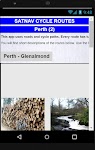
Satnav Cycle Routes – Perth(2) – Click to show
Satnav Cycle Routes – Perth(2)
Ian Lochhead
Perth - Glenalmond. 35 miles Perth - Crieff. 38 miles Perth - Milnathort. 38 miles Satnav Cycle Routes around Perth using cycle paths and roads. Every route has turn-by-turn navigation with voice in…
$0.99
0.0
0+ downloads
|
Maps & Navigation
0.0
$0.99
Ian Lochhead
0+ downloads
TRANSPORTATION
Satnav Cycle Routes – Perth(2)
Perth - Glenalmond. 35 miles Perth - Crieff. 38 miles Perth - Milnathort. 38 miles Satnav Cycle Routes around Perth us…
NZ Charts
Right Place Resources
This app includes a complete set of the LINZ marine charts for New Zealand as well as full route plotting and navigation functions. The charts can be downloaded for off-line use without cellular con…
$2.99
0.0
100+ downloads
|
Maps & Navigation
0.0
$2.99
Right Place Resources
100+ downloads
TRANSPORTATION
NZ Charts
This app includes a complete set of the LINZ marine charts for New Zealand as well as full route plotting and navigatio…
Kärnten Lakes - Austria Charts – Click to show
Kärnten Lakes - Austria Charts
MAPITECH LTD
MapiTech launches on the market the best official up-to-date combined with S57 nautical charts (digital): marinas, wrecks, fishing spots, boat ramps, POI. Lakes in this App : Aichwaldsee,AfritzerSe…
$4.99
0.0
5+ downloads
|
Maps & Navigation
0.0
$4.99
MAPITECH LTD
5+ downloads
TRANSPORTATION
Kärnten Lakes - Austria Charts
MapiTech launches on the market the best official up-to-date combined with S57 nautical charts (digital): marinas, wre…
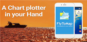
Boating Sydney Nautical Charts – Click to show
Boating Sydney Nautical Charts
FLYTOMAP INC
Flytomap is a valid and interesting alternative, Featured on Geomedia Worldwide Marine and Outdoor Maps available when connected, thanks to viewer.flytomap.com Worldwide Satellite images overlay on …
$3.99
0.0
10+ downloads
|
Maps & Navigation
0.0
$3.99
FLYTOMAP INC
10+ downloads
TRANSPORTATION
Boating Sydney Nautical Charts
Flytomap is a valid and interesting alternative, Featured on Geomedia Worldwide Marine and Outdoor Maps available when…
Region Of Murcia GPS Navigator – Click to show
Region Of Murcia GPS Navigator
FLYTOMAP INC
Flytomap is a valid and interesting alternative, Worldwide Marine and Outdoor Maps available when connected, thanks to viewer.flytomap.com Worldwide Satellite images overlay on charts Worldwide Terr…
$3.99
0.0
1+ downloads
|
Maps & Navigation
0.0
$3.99
FLYTOMAP INC
1+ downloads
TRANSPORTATION
Region Of Murcia GPS Navigator
Flytomap is a valid and interesting alternative, Worldwide Marine and Outdoor Maps available when connected, thanks to …
Wilson Lake Alabama GPS Charts – Click to show
Wilson Lake Alabama GPS Charts
FLYTOMAP INC
Flytomap is a valid and interesting alternative, Featured on the Deck Featured on Geomedia Worldwide Marine and Outdoor Maps available when connected, thanks to viewer.flytomap.com Worldwide Satellit…
$2.99
0.0
0+ downloads
|
Maps & Navigation
0.0
$2.99
FLYTOMAP INC
0+ downloads
TRANSPORTATION
Wilson Lake Alabama GPS Charts
Flytomap is a valid and interesting alternative, Featured on the Deck Featured on Geomedia Worldwide Marine and Outdoor…
Smith Mountain Lake GPS Charts – Click to show
Smith Mountain Lake GPS Charts
FLYTOMAP INC
Flytomap is a valid and interesting alternative, Featured on the Deck Featured on Geomedia Worldwide Marine and Outdoor Maps available when connected, thanks to viewer.flytomap.com Worldwide Satellit…
$3.99
0.0
10+ downloads
|
Maps & Navigation
0.0
$3.99
FLYTOMAP INC
10+ downloads
TRANSPORTATION
Smith Mountain Lake GPS Charts
Flytomap is a valid and interesting alternative, Featured on the Deck Featured on Geomedia Worldwide Marine and Outdoor…
UTM Grid Ref Compass
Mike Irving
Never be lost again! Find out your current UTM Grid Reference Map location anywhere in the world. UTM refers to the Universal Transverse Mercator geographic coordinate system. Your current Compass …
$0.99
0.0
100+ downloads
|
Maps & Navigation
0.0
$0.99
Mike Irving
100+ downloads
TRANSPORTATION
UTM Grid Ref Compass
Never be lost again! Find out your current UTM Grid Reference Map location anywhere in the world. UTM refers to the Un…
Satnav CycleRoutes–Dunfermline – Click to show
Satnav CycleRoutes–Dunfermline
Ian Lochhead
Dunfermline - Kincardine. 28.6 miles Dunfermline - Limekilns. 14.4 miles Satnav Cycle Routes around Dunfermline using cycle paths and roads. Every route has turn-by-turn navigation with voice instru…
$0.99
0.0
0+ downloads
|
Maps & Navigation
0.0
$0.99
Ian Lochhead
0+ downloads
TRANSPORTATION
Satnav CycleRoutes–Dunfermline
Dunfermline - Kincardine. 28.6 miles Dunfermline - Limekilns. 14.4 miles Satnav Cycle Routes around Dunfermline using …
The Blue Hills Reservation Map – Click to show
The Blue Hills Reservation Map
FLYTOMAP INC
Flytomap is a valid and interesting alternative, Featured on the Deck Featured on Geomedia Try now the new FlyToMap web viewer to see all available maps worldwide !!! Visit viewer.flytomap.com &ldqu…
$3.99
0.0
1+ downloads
|
Maps & Navigation
0.0
$3.99
FLYTOMAP INC
1+ downloads
TRANSPORTATION
The Blue Hills Reservation Map
Flytomap is a valid and interesting alternative, Featured on the Deck Featured on Geomedia Try now the new FlyToMap web…
Gps For Boat fishing & Car - P
V.Mark.
Be careful after the application is installed and the map appears, close and reopen the application to work properly. Maps: Satellite,Simple,Terrain,OpenStreetMap,Seamap,OpenTopo This GPS is speci…
$12.99
0.0
10+ downloads
|
Maps & Navigation
0.0
$12.99
V.Mark.
10+ downloads
TRANSPORTATION
Gps For Boat fishing & Car - P
Be careful after the application is installed and the map appears, close and reopen the application to work properly. …
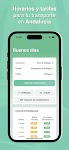
Transportes Andalucía PRO
Fran Caballero Software
AVAILABLE ON ENGLISH. Enhance your journeys across Andalusia (Andalucía, Spain) with our public transportation app. Instantly access updated schedules for buses, trains, metro, and boats acro…
$3.49
0.0
10+ downloads
|
Maps & Navigation
0.0
$3.49
Fran Caballero Software
10+ downloads
TRANSPORTATION
Transportes Andalucía PRO
AVAILABLE ON ENGLISH. Enhance your journeys across Andalusia (Andalucía, Spain) with our public transportation …
Isola del Giglio GPS Navigator – Click to show
Isola del Giglio GPS Navigator
FLYTOMAP INC
Flytomap is a valid and interesting alternative, Featured on the Deck Featured on Geomedia Worldwide Marine and Outdoor Maps available when connected, thanks to viewer.flytomap.com Worldwide Satelli…
$3.99
0.0
0+ downloads
|
Maps & Navigation
0.0
$3.99
FLYTOMAP INC
0+ downloads
TRANSPORTATION
Isola del Giglio GPS Navigator
Flytomap is a valid and interesting alternative, Featured on the Deck Featured on Geomedia Worldwide Marine and Outdoo…
Old Hickory Lake GPS Charts – Click to show
Old Hickory Lake GPS Charts
FLYTOMAP INC
Flytomap is a valid and interesting alternative, Featured on the Deck Featured on Geomedia Worldwide Marine and Outdoor Maps available when connected, thanks to viewer.flytomap.com Worldwide Satelli…
$3.99
0.0
1+ downloads
|
Maps & Navigation
0.0
$3.99
FLYTOMAP INC
1+ downloads
TRANSPORTATION
Old Hickory Lake GPS Charts
Flytomap is a valid and interesting alternative, Featured on the Deck Featured on Geomedia Worldwide Marine and Outdoo…
GPS Compass Navigation Pro
Darko Belev
From now on your hiking, hill climbing and walking will be easy. Use compass, navigation, record your routes, save your locations, take photos with GPS tag... and much more. COMPASS - Magnetic and t…
$4.99
0.0
50+ downloads
|
Maps & Navigation
0.0
$4.99
Darko Belev
50+ downloads
TRANSPORTATION
GPS Compass Navigation Pro
From now on your hiking, hill climbing and walking will be easy. Use compass, navigation, record your routes, save your…
Arst Finder - Premium
Luca Sanna
ARST FINDER permette la ricerca di tratte e prezzi dei mezzi pubblici ARST. Permette la visualizzazione di: - Orari e prezzi inserendo la fermata di partenza e di arrivo. - Dettaglio del percor…
$0.99
0.0
100+ downloads
|
Maps & Navigation
0.0
$0.99
Luca Sanna
100+ downloads
TRANSPORTATION
Arst Finder - Premium
ARST FINDER permette la ricerca di tratte e prezzi dei mezzi pubblici ARST. Permette la visualizzazione di: - Orari…
Satnav Cycle Routes – York – Click to show
Satnav Cycle Routes – York
Ian Lochhead
3 Satnav Cycle Routes around York. 1. Around York - 19.5 miles 2. York to Stamford Bridge - 28.3 miles 3. York to Tadcaster - 21.3 miles Satnav Cycle Routes around York using cycle paths and roads. …
$0.99
0.0
1+ downloads
|
Maps & Navigation
0.0
$0.99
Ian Lochhead
1+ downloads
TRANSPORTATION
Satnav Cycle Routes – York
3 Satnav Cycle Routes around York. 1. Around York - 19.5 miles 2. York to Stamford Bridge - 28.3 miles 3. York to Tadca…
Sempach Hallwil Baldegg Charts – Click to show
Sempach Hallwil Baldegg Charts
MAPITECH LTD
MapiTech launches on the market the best official up-to-date RNC (raster) combined with S57 nautical charts (digital): marinas, wrecks, fishing spots, boat ramps, POI. This app displays seamlessly …
$4.99
0.0
10+ downloads
|
Maps & Navigation
0.0
$4.99
MAPITECH LTD
10+ downloads
TRANSPORTATION
Sempach Hallwil Baldegg Charts
MapiTech launches on the market the best official up-to-date RNC (raster) combined with S57 nautical charts (digital):…
Altimeter Pro - Elevation – Click to show
Altimeter Pro - Elevation
dataWorks
This app has developed with love in Switzerland. No data is collected or shared. Support us with the price of a coffee! Thank you!! Main features: • Display of altitude (above sea level), accur…
$1.99
0.0
5+ downloads
|
Maps & Navigation
0.0
$1.99
dataWorks
5+ downloads
TRANSPORTATION
Altimeter Pro - Elevation
This app has developed with love in Switzerland. No data is collected or shared. Support us with the price of a coffee!…
United States
United Kingdom
Germany
Norway
Sweden
Australia
Netherlands
Italy
Denmark
Hong Kong
Brazil
France
Canada
Spain
Portugal
South Korea
Japan
Poland
Hungary
India
Finland
Thailand
Russia
General
Overall
Applications
Games
Join AppBrain
Join AppBrain to get app recommendations
Apps
Art & Design
Auto & Vehicles
Beauty
Books & Reference
Business
Comics
Communication
Dating
Education
Entertainment
Events
Finance
Food & Drink
Health & Fitness
House & Home
Libraries & Demo
Lifestyle
Maps & Navigation
Medical
Music & Audio
News & Magazines
Parenting
Personalization
Photography
Productivity
Shopping
Social
Sports
Tools
Travel & Local
Video Players & Editors
Weather
Games
Action
Adventure
Arcade
Board
Card
Casino
Casual
Educational
Music
Puzzle
Racing
Role Playing
Simulation
Sports Games
Strategy
Trivia
Word