AppBrain
|
Apps
Apps
Apps being viewed right now
Trending apps today
Most popular apps
All-time most downloaded apps
Top rated apps
Statistics
Docs
Developers
Sign up
Log in
Android Apps
>
Maps & Navigation
>
Paid
Category
Maps & Navigation
Sort by
Trending
Recent downloads
All-time downloads
Top rated
Popular in
Filter by
Off
Free
Paid
New
Updated
Price Reduced
No ads
Page 3 of the
trending Paid Maps & Navigation Apps for Android right now
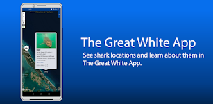
The Great White App
Sustainable Oceans Society
READ BEFORE PURCHASING: * This app will always be FREE on our website, sustainableoceansociety.co.nz * By purchasing this app you are supporting The Great White Project - a study of Great White Sha…
$2.99
0.0
1,000+ downloads
|
Maps & Navigation
0.0
$2.99
Sustainable Oceans Society
1,000+ downloads
TRANSPORTATION
The Great White App
READ BEFORE PURCHASING: * This app will always be FREE on our website, sustainableoceansociety.co.nz * By purchasing …
Float LOZ
Jason Sanford
Lake of the Ozarks' boating app. Learn your way around Lake of the Ozarks. Navigate to marinas, boat launches, restaurants, mile markers, and more. Save your favorite spots and share them with friend…
$2.99
0.0
10+ downloads
|
Maps & Navigation
0.0
$2.99
Jason Sanford
10+ downloads
TRANSPORTATION
Float LOZ
Lake of the Ozarks' boating app. Learn your way around Lake of the Ozarks. Navigate to marinas, boat launches, restaura…
Mojo TSD Navigator
RallyOn
Mojo TSD Navigator allows a time-speed-distance rally navigator (co-driver) to report to the driver whether to speed up or slow down in order to arrive at the next rally checkpoint exactly on time an…
$19.99
0.0
10+ downloads
|
Maps & Navigation
0.0
$19.99
RallyOn
10+ downloads
TRANSPORTATION
Mojo TSD Navigator
Mojo TSD Navigator allows a time-speed-distance rally navigator (co-driver) to report to the driver whether to speed up…
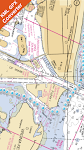
Cayuga Seneca Lakes GPS Charts – Click to show
Cayuga Seneca Lakes GPS Charts
MAPITECH LTD
MapiTech launches on the market the best official up-to-date NOAA RNC (raster) combined with S57 nautical charts (digital): marinas, wrecks, fishing spots, boat ramps, POI. This app displays seamles…
$4.99
0.0
0+ downloads
|
Maps & Navigation
0.0
$4.99
MAPITECH LTD
0+ downloads
TRANSPORTATION
Cayuga Seneca Lakes GPS Charts
MapiTech launches on the market the best official up-to-date NOAA RNC (raster) combined with S57 nautical charts (digit…
Almicantarat
Pierre-Louis Deschamps
Enjoy shooting stars, planets and the Sun with an easy-to-use, professional and accurate celestial navigation app. Features a smooth 3D Sky Map. Check the celestial fix on the device native map. Use …
$4.99
0.0
50+ downloads
|
Maps & Navigation
0.0
$4.99
Pierre-Louis Deschamps
50+ downloads
TRANSPORTATION
Almicantarat
Enjoy shooting stars, planets and the Sun with an easy-to-use, professional and accurate celestial navigation app. Feat…
Champlain lake Offline Charts – Click to show
Champlain lake Offline Charts
MAPITECH LTD
MapiTech launches on the market the best official up-to-date NOAA RNC (raster) combined with S57 nautical charts (digital): marinas, wrecks, fishing spots, boat ramps, POI. This app displays seamles…
$4.99
0.0
50+ downloads
|
Maps & Navigation
0.0
$4.99
MAPITECH LTD
50+ downloads
TRANSPORTATION
Champlain lake Offline Charts
MapiTech launches on the market the best official up-to-date NOAA RNC (raster) combined with S57 nautical charts (digit…
Lake Norman GPS Offline Charts – Click to show
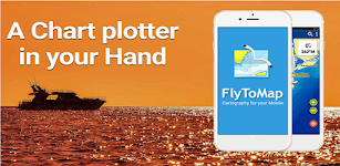
Lake Norman GPS Offline Charts
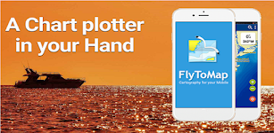
FLYTOMAP INC
Flytomap is a valid and interesting alternative Featured on the Deck Featured on Geomedia Lake Norman coverage resident in the app. It works WITHOUT mobile coverage! Worldwide Marine and Outdoor M…
$3.99
0.0
100+ downloads
|
Maps & Navigation
0.0
$3.99
FLYTOMAP INC
100+ downloads
TRANSPORTATION
Lake Norman GPS Offline Charts
Flytomap is a valid and interesting alternative Featured on the Deck Featured on Geomedia Lake Norman coverage residen…
US East Gps Map Navigator – Click to show
US East Gps Map Navigator
FLYTOMAP INC
Flytomap is a valid and interesting alternative, Worldwide Marine and Outdoor Maps available when connected, thanks to viewer.flytomap.com Worldwide Satellite images overlay on charts Worldwide Terr…
$4.99
0.0
10+ downloads
|
Maps & Navigation
0.0
$4.99
FLYTOMAP INC
10+ downloads
TRANSPORTATION
US East Gps Map Navigator
Flytomap is a valid and interesting alternative, Worldwide Marine and Outdoor Maps available when connected, thanks to …
Florida Everglades GPS Charts – Click to show
Florida Everglades GPS Charts
FLYTOMAP INC
Flytomap is a valid and interesting alternative, Featured on the Deck Featured on Geomedia Worldwide Marine and Outdoor Maps available when connected, thanks to viewer.flytomap.com Worldwide Satellit…
$3.99
0.0
0+ downloads
|
Maps & Navigation
0.0
$3.99
FLYTOMAP INC
0+ downloads
TRANSPORTATION
Florida Everglades GPS Charts
Flytomap is a valid and interesting alternative, Featured on the Deck Featured on Geomedia Worldwide Marine and Outdoor…
Spain Mediterranean GPS Charts – Click to show
Spain Mediterranean GPS Charts
FLYTOMAP INC
Flytomap is a valid and interesting alternative, Featured on the Deck Featured on Geomedia Worldwide Marine and Outdoor Maps available when connected, thanks to viewer.flytomap.com Worldwide Satellit…
$4.99
0.0
50+ downloads
|
Maps & Navigation
0.0
$4.99
FLYTOMAP INC
50+ downloads
TRANSPORTATION
Spain Mediterranean GPS Charts
Flytomap is a valid and interesting alternative, Featured on the Deck Featured on Geomedia Worldwide Marine and Outdoor…
Potomac River Was GPS Charts – Click to show
Potomac River Was GPS Charts
FLYTOMAP INC
Flytomap is a valid and interesting alternative, Worldwide Marine and Outdoor Maps available when connected, thanks to viewer.flytomap.com Worldwide Satellite images overlay on charts Worldwide Ter…
$2.99
0.0
10+ downloads
|
Maps & Navigation
0.0
$2.99
FLYTOMAP INC
10+ downloads
TRANSPORTATION
Potomac River Was GPS Charts
Flytomap is a valid and interesting alternative, Worldwide Marine and Outdoor Maps available when connected, thanks to…
Black Hills NF Map Navigator – Click to show
Black Hills NF Map Navigator
FLYTOMAP INC
Flytomap is a valid and interesting alternative, Featured on the Deck Featured on Geomedia Try now the new FlyToMap web viewer to see all available maps worldwide !!! Visit viewer.flytomap.com &ldqu…
$3.99
0.0
1+ downloads
|
Maps & Navigation
0.0
$3.99
FLYTOMAP INC
1+ downloads
TRANSPORTATION
Black Hills NF Map Navigator
Flytomap is a valid and interesting alternative, Featured on the Deck Featured on Geomedia Try now the new FlyToMap web…
Ireland GPS Map Navigator – Click to show
Ireland GPS Map Navigator
FLYTOMAP INC
Flytomap is a valid and interesting alternative, Featured on the Deck Featured on Geomedia Worldwide Marine and Outdoor Maps available when connected, thanks to viewer.flytomap.com Worldwide Satelli…
$3.99
0.0
10+ downloads
|
Maps & Navigation
0.0
$3.99
FLYTOMAP INC
10+ downloads
TRANSPORTATION
Ireland GPS Map Navigator
Flytomap is a valid and interesting alternative, Featured on the Deck Featured on Geomedia Worldwide Marine and Outdoo…
Grand lake o the Cherokees Map – Click to show
Grand lake o the Cherokees Map
MAPITECH LTD
MapiTech launches on the market the best official up-to-date NOAA RNC (raster) combined with S57 nautical charts (digital): marinas, wrecks, fishing spots, boat ramps, POI. This app displays seamles…
$4.99
0.0
1+ downloads
|
Maps & Navigation
0.0
$4.99
MAPITECH LTD
1+ downloads
TRANSPORTATION
Grand lake o the Cherokees Map
MapiTech launches on the market the best official up-to-date NOAA RNC (raster) combined with S57 nautical charts (digit…
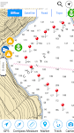
Compass Pro
Fulmine Software
Always be informed about north, your heading (azimuth) and location. Main advantages of our Compass app: • Beautiful and modern material design style. • Status bar notification - know your…
$2.49
4.6
5,000+ downloads
|
Maps & Navigation
4.6
$2.49
Fulmine Software
5,000+ downloads
TRANSPORTATION
Compass Pro
Always be informed about north, your heading (azimuth) and location. Main advantages of our Compass app: • Beauti…
Egadi Island Offline GPS Chart – Click to show
Egadi Island Offline GPS Chart
MAPITECH LTD
MapiTech launches on the market the best official up-to-date RNC (raster) combined with S57 nautical charts (digital): marinas, wrecks, fishing spots, boat ramps, POI. This app displays seamlessly …
$4.99
0.0
1+ downloads
|
Maps & Navigation
0.0
$4.99
MAPITECH LTD
1+ downloads
TRANSPORTATION
Egadi Island Offline GPS Chart
MapiTech launches on the market the best official up-to-date RNC (raster) combined with S57 nautical charts (digital):…
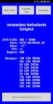
World Airports Pro
Waterline Software
World Airports Pro is a worldwide database of over 5000 of the world's principle airports and their runways permitting location and orientation through the medium of Google® Maps. Within this ap…
$1.49
0.0
100+ downloads
|
Maps & Navigation
0.0
$1.49
Waterline Software
100+ downloads
TRANSPORTATION
World Airports Pro
World Airports Pro is a worldwide database of over 5000 of the world's principle airports and their runways permitting …
Norris Lake TN Offline Charts – Click to show
Norris Lake TN Offline Charts
MAPITECH LTD
MapiTech launches on the market the best official up-to-date NOAA RNC (raster) combined with S57 nautical charts (digital): marinas, wrecks, fishing spots, boat ramps, POI. This app displays seamles…
$4.99
0.0
10+ downloads
|
Maps & Navigation
0.0
$4.99
MAPITECH LTD
10+ downloads
TRANSPORTATION
Norris Lake TN Offline Charts
MapiTech launches on the market the best official up-to-date NOAA RNC (raster) combined with S57 nautical charts (digit…
Lake District Outdoor Map Pro – Click to show
Lake District Outdoor Map Pro
jonathan shutt
An offline map of the Lake District National Park in England, ideal for hiking, running, mountain biking / cycling. Being offline means unlike other map apps, you don't need a signal to access detail…
$1.99
0.0
1,000+ downloads
|
Maps & Navigation
0.0
$1.99
jonathan shutt
1,000+ downloads
TRANSPORTATION
Lake District Outdoor Map Pro
An offline map of the Lake District National Park in England, ideal for hiking, running, mountain biking / cycling. Bei…
Harry S Truman RSVR GPS Charts – Click to show
Harry S Truman RSVR GPS Charts
MAPITECH LTD
MapiTech launches on the market the best official up-to-date NOAA RNC (raster) combined with S57 nautical charts (digital): marinas, wrecks, fishing spots, boat ramps, POI. This app displays seamles…
$4.99
0.0
0+ downloads
|
Maps & Navigation
0.0
$4.99
MAPITECH LTD
0+ downloads
TRANSPORTATION
Harry S Truman RSVR GPS Charts
MapiTech launches on the market the best official up-to-date NOAA RNC (raster) combined with S57 nautical charts (digit…
United States
United Kingdom
Germany
Norway
Sweden
Australia
Netherlands
Italy
Denmark
Hong Kong
Brazil
France
Canada
Spain
Portugal
South Korea
Japan
Poland
Hungary
India
Finland
Thailand
Russia
General
Overall
Applications
Games
Join AppBrain
Join AppBrain to get app recommendations
Apps
Art & Design
Auto & Vehicles
Beauty
Books & Reference
Business
Comics
Communication
Dating
Education
Entertainment
Events
Finance
Food & Drink
Health & Fitness
House & Home
Libraries & Demo
Lifestyle
Maps & Navigation
Medical
Music & Audio
News & Magazines
Parenting
Personalization
Photography
Productivity
Shopping
Social
Sports
Tools
Travel & Local
Video Players & Editors
Weather
Games
Action
Adventure
Arcade
Board
Card
Casino
Casual
Educational
Music
Puzzle
Racing
Role Playing
Simulation
Sports Games
Strategy
Trivia
Word