Users love it: 4.9 stars from 6,200 ratings. Its best ranking is #90 in Top Grossing, Navigation in United States.
Argo Navigation: Boat GPS, Map is made and published by
ARGO TECHNOLOGIES, LLC.
AppBrain is an independent app data site and isn't affiliated with ARGO TECHNOLOGIES, LLC.
The app name, icon, screenshots and description belong to ARGO TECHNOLOGIES, LLC and are shown as
published on the App Store.
About Argo Navigation: Boat GPS, Map
Argo Navigation: Boat GPS, Map is a navigation app developed by ARGO TECHNOLOGIES, LLC.
What is the rating of Argo Navigation: Boat GPS, Map?
Argo Navigation: Boat GPS, Map is rated 4.90 out of 5 stars, based on 6.2 thousand ratings.
Is Argo Navigation: Boat GPS, Map free?
Argo Navigation: Boat GPS, Map is free. The app size is 137.78 MB. The latest version available is 3.12.0. The last update was on October 7, 2026.
What are the requirements for Argo Navigation: Boat GPS, Map?
The app has a content rating of Everyone. The app has been available on the App Store since September 2019.
Description by ARGO TECHNOLOGIES, LLC(from the App Store)
Argo is a boat navigation app you can actually use for free. Not a trial. You get NOAA charts and U.S. Army Corps of Engineers depth surveys for US waters, 500,000+ marinas, anchorages and fuel docks, hazards reported by other boaters, and routes you plot yourself, with ETA and fuel use.
On your first trip, open the map to see how deep it is and read what other boaters say about the anchorage before you drop the hook. A hundred trips in, you're checking how old the Army Corps survey is before you run a shoaling inlet, or laying out a few route options and picking one underway.
Think of Argo as the boating buddy who knows every good dock bar and never asks for gas money.
FREE FOR EVERY BOATER
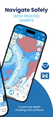
Navigate • Up-to-date NOAA charts plus Army Corps (USACE) surveys you can filter by survey date • Shoal areas, dredged channels, restricted areas and recommended tracks on the coast and inland rivers • See your GPS position and speed on the chart • Search buoys, beacons, lights, wrecks and mile markers • Record your track and use Return to follow it back • Depth shading presets, including two built for bright sun glare
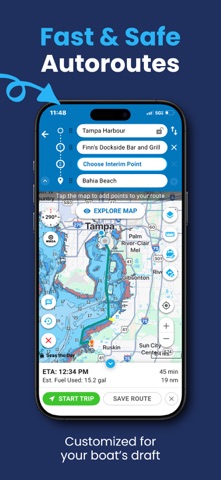
Plan • Search 500,000+ places, from boat ramps and moorings to non-ethanol fuel and dock bars • Read reviews from boaters who've been there • Plot your own route on the map and see distance, ETA and fuel use • A trip log of everywhere you've been
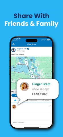
Connect • See other Argo boaters on the water and share your live location with family ashore • Join your boat club, marina or rally group • Share routes, places and trips, and post photos and video • Report hazards and see the ones other boaters have reported • Keep fishing spots private or share them with your group
One account works on every phone and tablet you own, free.
ARGO PREMIUM, WHEN YOU WANT MORE
Smarter routes • Autoroute plans around shallow water, hazards and restricted areas based on your boat's draft, height and safety buffer • Run inside or outside, or set Autoroute to stay in the marked channel • Save several routes to your chart, start a track, and choose between them underway • Have a sailboat and a powerboat? Save both, each with its own draft and height
Marine weather and tides • 7-day marine forecast: weather, wind, wave height and period, tides and currents • Wind, rain and lightning overlays on your chart • 6,000+ tide and current stations on your chart, with predictions as far ahead as you want • Tide variance right next to your depth gauge
On the water • Offline charts download automatically around your location and home port, for when you lose signal • Connect over NMEA (Wi-Fi gateway) for depth, speed and heading from your electronics, plus AIS targets • Custom depth shading and contours, so shallow water and fishing drop-offs stand out • Distance, time, bearing and course to your next turn, always in view
Logbook and planning tools • Import and export GPX routes and tracks between Argo and your chartplotter • Download a PDF trip report to document sea time toward your captain's license
Coverage: US coastal waters, the ICW, inland lakes and rivers, Canada and the Caribbean.
WHO'S BEHIND ARGO Argo is family-owned. Our founder, Captain Jeff, grew up boating on the Chesapeake Bay. He built Argo so the local knowledge usually shared between friends at the dock is on the map for everyone.
Many of our features started as boater requests. Send yours to support@argonav.io.
Argo is a navigation aid. Always check official charts and conditions, and use your own judgment on the water.
Plan. Navigate. Connect.
Terms of Use: https://www.apple.com/legal/internet-services/itunes/dev/stdeula/ Privacy Policy: https://www.argonav.io/privacy/
AppBrain offers valuable information about your app and those of your competitors. Join AppBrain for free and claim this app to view more ranking data, view history etc.
Each subscription will automatically renew 3 days before the expiration date for
the same time period. Subscriptions can be cancelled at any time before the renewal.