

iNavX: Marine Navigation
iNavX: Marine Navigation is made and published by NavX Studios LLC. AppBrain is an independent app data site and isn't affiliated with NavX Studios LLC. The app name, icon, screenshots and description belong to NavX Studios LLC and are shown as published on the App Store.
AppBrain's verdict
EstablishedLoved by users- Rating on App Store
- 4.76
- 21,786 ratings
- Last updated
- August 18, 2026
- Size
- 298.4 MB
Users love it: 4.8 stars from 21,786 ratings. Its best ranking is #41 in Top Grossing, Navigation in Belgium.
User feedback
Ratings and reviews on the App StoreComments on iNavX: Marine Navigation for iOS
We don't have enough comments to show example comments. Please check back later.
Store listing
By NavX Studios LLC, from the App Store

Description by NavX Studios LLC Written by the developer, not by AppBrain. Click to read.
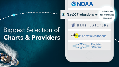
iNavX is the only app to give you complete worldwide chart coverage, from all your favorite charts providers, including the ALL NEW iNavX Professional+ Chart series! Fully enabled with one-touch access, iNavX gives users access to the broadest set of marine charts and maps from multiple providers including:
• iNavX Professional+ Charts
• Blue Latitude
• CHS
• Explorer
• Theyr Weather
• Waterway Guide
• … and more
How does iNavX take handheld marine navigation to the next level?
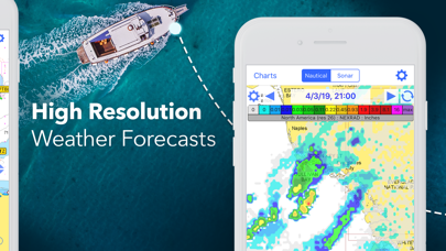
• Sailors - Plan sailing routes with waypoint and route management. Get proactive sail management with GRIB weather forecasts and then keep watch with AIS overlays and integration with your onboard systems. Plus, you can remember your great sailing locations by geotagging photos.
• Boaters - Stay up to date on boating conditions with forecasts that include currents, winds, and swells. Manage your boating equipment with nautical instrument integration and then save great boating routes to share with the track log.
• Anglers - Discover new fishing spots by scouting out holes and inlets. Locate the best fishing conditions by identifying cold fronts and save your best fishing spots with unlimited markers.
Advanced features - iNavX is the most feature rich app available for all sailing and boating needs at a great price:
Advanced Chart Plotter
• Plot your position in real-time using your device's built-in GPS
• Pan, zoom, and rotate charts (including course up)
• Print detailed charts to use in combination with the app
Advanced Navigation
• Create waypoints and plan routes to navigate between them
• Track log allows you to record your route
• Import/export data in KML (Google Earth) or GPX format
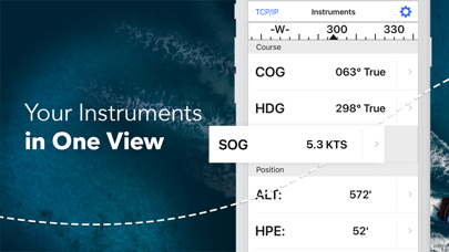
Advanced Instrumentation
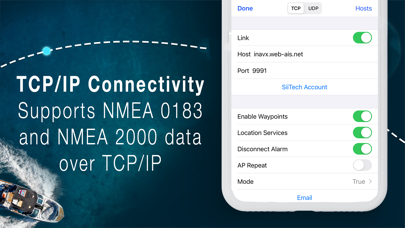
• Supports NMEA data over TCP/IP (using Wifi)
• Integrates with external GPS, AIS receivers & transponders
• Connect nautical instruments: Depth, Speed, Wind, Engine, Batteries, etc.
Essential Toolkit
• GRIB weather forecast
• Tides/currents
• Anchor alarm
• AIS integration
• Port/navaid search
Download iNavX TODAY and automatically receive a complimentary copy of the official and up-to-date high-resolution NOAA RNC United States marine raster charts.
REVIEWS
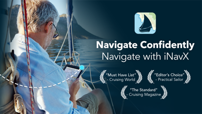
“iNavX is the original and still one of the best navigation apps.”
– Practical Sailor
“The most full-featured navigation app around and viewed by many as the standard”
– Sail Magazine
"The #1 recommended marine charting app"
- iMarineApps
iNavX is Compatible with: Theyr Weather, Waterway Guide, AIS, Brookhouse, DigitalYacht, ShipModul, vYacht, Vesper Marine, NMEA 2000, Chetco and more.
NEW CHART STORE
Purchase all your favorite charts. Chart subscriptions vary by chart and provider from $9.99 to $199.99 annually, charged to your iTunes Account, which will automatically renew unless cancelled at least 24 hours before the end of the current period. Auto-renew can be turned off anytime by going to your Account Settings in iTunes after purchase. No cancellation of the current subscription is allowed during active subscription period.
NOTE: Continued use of GPS running in the background can dramatically decrease battery life.
MORE INFO
Website: http://inavx.com/
User's Guide: http://inavx.com/help/
Terms of Use: http://inavx.com/terms
Privacy Policy: http://inavx.com/privacy
Safety and technology
Found in the app by AppBrain- Price
- Free
- App size
- 298.4 MB
- Content rating
- Everyone
Technologies used by iNavX: Marine Navigation
Releases
Updates seen on the App Store- Version
- 5.9.1
- Launched
- February 2019
No changelog data
Alternatives
Similar apps and more from NavX Studios LLCAlternatives to iNavX: Marine Navigation


Also available on Google Play

Rankings
App Store top charts- Highest rank
- #41
- Chart
- Top Grossing
- Navigation
- Country
- Belgium
About the app and developer
About iNavX: Marine Navigation
iNavX: Marine Navigation is a navigation app developed by NavX Studios LLC.
What is the rating of iNavX: Marine Navigation?
iNavX: Marine Navigation is rated 4.76 out of 5 stars, based on 22 thousand ratings.
Is iNavX: Marine Navigation free?
iNavX: Marine Navigation is free. The app size is 298.44 MB. The latest version available is 5.9.1. The last update was on August 18, 2026.
What are the requirements for iNavX: Marine Navigation?
The app has a content rating of Everyone. The app has been available on the App Store since February 2019.
Developer information for NavX Studios LLC
Address:
Frequently asked questions about iNavX: Marine Navigation
Is iNavX: Marine Navigation free?
Yes. iNavX: Marine Navigation is free on the App Store.
Is iNavX: Marine Navigation still available?
Yes. iNavX: Marine Navigation is on the App Store, and the last update we saw was on August 18, 2026.
How large is iNavX: Marine Navigation?
iNavX: Marine Navigation is 298.44 MB.
Is iNavX: Marine Navigation suitable for children?
App Store rates the content of iNavX: Marine Navigation as suitable for everyone.
How do people rate iNavX: Marine Navigation?
iNavX: Marine Navigation scores 4.76 out of 5 stars, from 21,786 ratings on the App Store.
Who made iNavX: Marine Navigation?
iNavX: Marine Navigation was developed by NavX Studios LLC. It is listed in the navigation category on the App Store.
What are the best alternatives to iNavX: Marine Navigation?
People looking at iNavX: Marine Navigation also look at these navigation apps: PRO CHARTS - Marine Navigation, Savvy Navvy: Boat Navigation, i-Boating: Marine Charts & Gps, Navionics® Boating, Aqua Map Boating.