EasyView is made and published by
Syslor.
AppBrain is an independent app data site and isn't affiliated with Syslor.
The app name, icon, screenshots and description belong to Syslor and are shown as
published on the App Store.
About EasyView
EasyView is an utilities app developed by Syslor.
What is the rating of EasyView?
EasyView has no ratings yet.
Is EasyView free?
EasyView is free. The app size is 301.03 MB. The latest version available is 6.2.0. The last update was on August 26, 2026.
What are the requirements for EasyView?
The app has a content rating of Everyone. The app has been available on the App Store since May 2021.
Description by Syslor(from the App Store)
Visualize your underground utilities in augmented reality for enhanced precision and safety. EasyView turns your iPhone or iPad into a 3D visualization tool for underground networks, right on site. With augmented reality and GNSS precision, you mark, stake, and maintain markings in seconds, while reducing damages and delays. An immersive, intuitive, ready-to-use solution with unlimited usage.
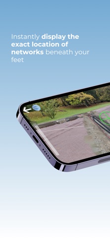
EasyView redefines how you interact with underground networks: instantly display the exact location of utilities beneath your feet, overlaid on your camera's real-time view. Gain efficiency and safety during marking, staking, and maintenance operations.
Key features: - 3D augmented reality visualization of underground utilities with their accuracy class - Simplified marking and staking: locate and mark faster, with less risk of damage. - Integrated marking report: certify your interventions and track maintenance directly from the app. - Utility plan conversion and visualization: import your files (DXF, DWG, IFC, OBJ, SHP, StaR-DT) and display them in augmented reality. - Multi-receiver GNSS compatibility: works with Proteus (Syslor), Pyx (Teria), Reach RX and Reach RS3 (Emlid).
Designed for all field stakeholders: - Site managers: secure your operations and reduce the risk of asset damage. - Surveyors: supervise marking and staking remotely, with certified data. - Field operators: visualize your networks directly on site, without technical expertise.
EasyView advantages: - Damage reduction: precise visualization for safer marking. - Time savings: reduce your marking and maintenance times by four. - Centimeter-level GNSS precision: CCTA certified, adapted to network operators' requirements. - Ease of use: intuitive, no surveying background required. - Enhanced safety: immersive and reliable visualization for your teams. - Complete interoperability: DXF, DWG, IFC, OBJ, SHP, StaR-DT formats.
EasyView runs on iPhone and iPad, connected to your preferred GNSS receiver (Proteus, Pyx or Reach RS3/RX). Dive into your underground networks and visualize them at real scale, wherever you are.
Discover EasyView in action or request a demonstration at www.syslor.net/en/our-solutions/easyview/#DemoEasyView
Each subscription will automatically renew 3 days before the expiration date for
the same time period. Subscriptions can be cancelled at any time before the renewal.