

Users love it: 4.7 stars from 131 ratings.
EDDMapS is made and published by Charles T. Bargeron. AppBrain is an independent app data site and isn't affiliated with Charles T. Bargeron. The app name, icon, screenshots and description belong to Charles T. Bargeron and are shown as published on the App Store.
About EDDMapS
EDDMapS is an utilities app developed by Charles T. Bargeron.
User Ratings
EDDMapS is rated 4.67 out of 5 stars. The rating is based on 130 ratings.
App Information
EDDMapS is freely available from the App Store. The app size is 251.28 MB. The latest version available is 2.3.3. The last update was on September 23, 2026.
Technical Requirements
The app has a content rating of Everyone. The app has been available on the App Store since June 2020.
More data about EDDMapS
| Price | Free |
| Rating | 4.67 based on 130 ratings |
| Ranking | Not ranked |
| Version | 2.3.3 |
| App size | 251.3 MB |
| Suitable for | Everyone |
Screenshots
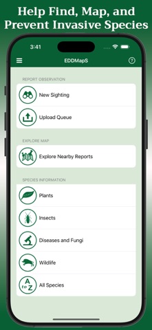

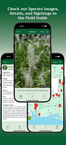
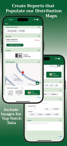

Also available on Google Play

Alternatives to EDDMapS




More from Charles T. Bargeron


Changelog of EDDMapS
No changelog data
Developer information for Charles T. Bargeron
Address:
Comments on EDDMapS for iOS
We don't have enough comments to show example comments. Please check back later.
App Store Rankings for EDDMapS
Technologies used by EDDMapS
Frequently asked questions about EDDMapS
Is EDDMapS free?
Yes. EDDMapS is free on the App Store.
Is EDDMapS still available?
Yes. EDDMapS is on the App Store, and the last update we saw was on September 23, 2026.
How large is EDDMapS?
EDDMapS is 251.28 MB.
Is EDDMapS suitable for children?
App Store rates the content of EDDMapS as suitable for everyone.
How do people rate EDDMapS?
EDDMapS scores 4.67 out of 5 stars, from 131 ratings on the App Store.
Who made EDDMapS?
EDDMapS was developed by Charles T. Bargeron. It is listed in the utilities category on the App Store.
What are the best alternatives to EDDMapS?
People looking at EDDMapS also look at these utilities apps: ArcGIS QuickCapture, ArcGIS Survey123, VuSitu, Geode Connect, Project Monarch Science.