GPS Map Camera - GeoLens Cam! is an overall app developed by ViPrak Web Solutions.
How many times has GPS Map Camera - GeoLens Cam! been downloaded?
What is the rating of GPS Map Camera - GeoLens Cam!?
GPS Map Camera - GeoLens Cam! has no ratings yet.
Is GPS Map Camera - GeoLens Cam! free?
GPS Map Camera - GeoLens Cam! is free to download. The APK download size is 81.67 MB. The latest version available is 1.8. The last update was on April 3, 2026.
What are the requirements for GPS Map Camera - GeoLens Cam!?
The app has a content rating of Everyone. The app has been available on Google Play May 2025.
Description
GPS Map Camera - GeoLens: Capture, Tag & Explore Your World
Frame Your Journey with Precision Discover a whole new way to capture and document your travels with **GPS Map Camera - GeoLens**, the perfect companion for explorers, professionals, and memory-makers. Whether you're trekking through scenic landscapes, documenting business locations, or simply sharing moments with geo-tagged photos, **GeoLens** empowers you to snap, tag, and navigate effortlessly.
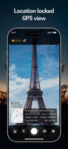
Capture with GPS Precision Your photos are more than just snapshots; they are memories with a location. With **GeoLens**, every photo you take is seamlessly stamped with precise **GPS coordinates, location address, date, time, and more**. Ideal for travelers, journalists, photographers, and professionals needing accurate geotagged images.
Key Features Auto GPS Tagging - Instantly embed latitude, longitude, altitude, and compass direction into your photos. - Capture exact location details, including city, street name, and area. - Works globally—whether you're exploring bustling cities or serene landscapes.
Customizable Stamps - Personalize your photos with date, time, address, weather info, and altitude. - Choose from multiple stylish stamp designs to suit your purpose. - Adjust fonts, colors, and stamp position for a professional touch.
Weather & Environment Data - Embed real-time weather conditions including temperature, humidity, and atmospheric pressure. - Showcase your surroundings with detailed environmental insights.
Professional Utility - Perfect for real estate agents, field professionals, and surveyors to document locations. - Supports businesses requiring proof of visit, travel bloggers, and explorers. - Create location-based photo reports with ease.
Offline & Sync Features - Capture geo-tagged photos without an internet connection—data syncs when online. - Save photos in high resolution with embedded GPS metadata. - Export and share images via email, social media, or cloud storage.
Simple, Intuitive & User-Friendly With an easy-to-use interface, **GPS Map Camera - GeoLens** makes geotagging seamless for everyone.
1. Open the app and point your camera. 2. Capture the moment—location details are auto-stamped. 3. Customize your tags and share your masterpiece instantly.
Who Benefits from GeoLens? - Travel Enthusiasts: Stamp your travel experiences with precise locations. - Real Estate Agents: Showcase properties with accurate GPS stamps. - Field Professionals: Document surveys and inspections efficiently. - Bloggers & Photographers: Add authenticity to your captures.
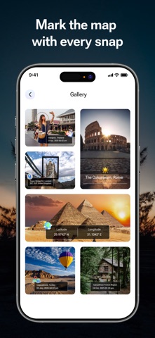
Share & Impress Post geo-tagged images directly on Facebook, Instagram, WhatsApp, and more to let your friends and followers explore your journey.
---
Download GPS Map Camera - GeoLens Today Take photos that tell a story—beyond just an image, with embedded location data. Capture, tag, and explore effortlessly—**GeoLens is your ultimate GPS camera.** Get it now and turn your moments into mapped memories.
Privacy policy: https://www.viprak.com/privacy Terms of Use: https://www.viprak.com/terms
Each subscription will automatically renew 3 days before the expiration date for
the same time period. Subscriptions can be cancelled at any time before the renewal.