Maps Tools,GPS tracking,Speed is an overall app developed by Laurent Simond.
Download Statistics
User Ratings
The app has no ratings yet.
App Information
Maps Tools,GPS tracking,Speed costs $0.99 to download. The APK download size is 4.42 MB. The latest version available is 2.1. The last update was on October 21, 2025.
Technical Requirements
The app has a content rating of Everyone. The app has been available on Google Play November 2017.
Description
The application MapsTools supplies a set of tools working with MAPS
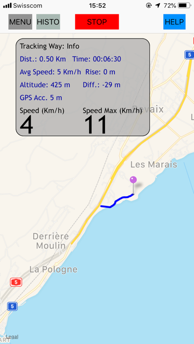
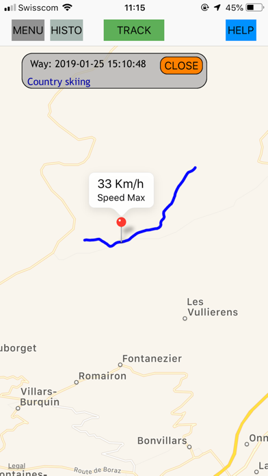
1) GPS Tracking Draws your travel on MAPS Records your travel Shows information about your travel - Max Speed - Average Speed, Current Speed - Distance - Elapsed time - Altitude, Altitude Difference, Rising Displays recorded trackings
Switchs between metric and imperial units system
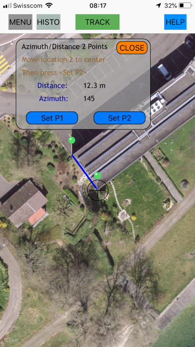
2) Distance between two locations and the azimuth to the second location - Select 2 locations on MAPS - The distance and the azimuth are displayed
Usage example: to measure an house dimension and orientation
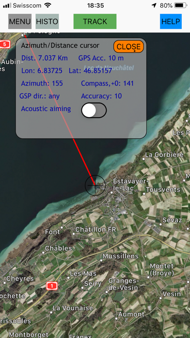
3) Azimuth and Distance to central cursor - Distance from your location to an other location - Azimuth line from your location to an other location - GPS coordinates other location - Acoustic aiming (a voice helps you to orient the device in the direction of the second location) - GPS Direction
When your location changes, the distance and the azimuth (the cap) are updated
It is possible to keep a cap (GPS direction, Left/Right arrows)
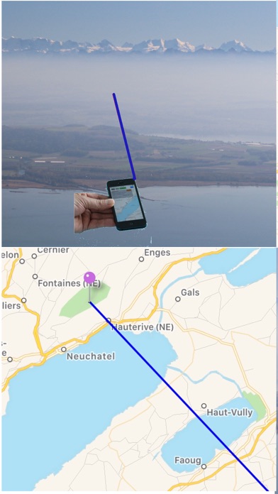
4) Azimuth line Sometimes, you'd like to know what you see far away - orient your device and touch the screen - a line is drawn on MAPS in the direction measured by the compass
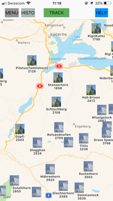
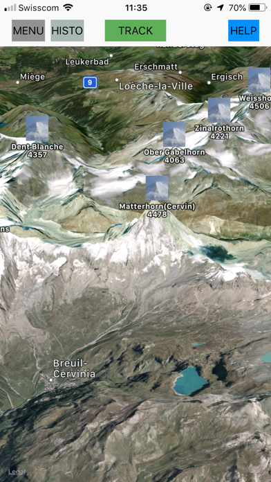
5) Possibility to show the swiss Mountains. To reduce the number of mountains, a filter on the altitude may be applied.
6) Display GPS information and Compass - GPS coordinates - Speed - Altitude - Horizontal and Vertical accuracy - GPS direction - Compass, Compass accuracy
7) Possibility to correct the compass If you see a geographic point you know and you can find it on the map, you have the possibility to set a compass correction
When the APP is not active (in background), the GPS is working only in the case the user has started the function GPS tracking
WARNING: - Don't use the application to get your way in dangerous environment. This application don't replace a topographic map and a good compass. - Without GPS, some features are not fully functional - The reliability of the functions azimuth line and azimuth/distance depends of - The reliability of the compass - The GPS reliability - The right device orientation - The GPS increases the energy consumption - The Maps refreshing consumes internet data and energy
Each subscription will automatically renew 3 days before the expiration date for
the same time period. Subscriptions can be cancelled at any time before the renewal.