It doesn't have enough ratings yet to judge what users think.
RTAB-Map - 3D LiDAR Scanner is made and published by
Mathieu Labbe.
AppBrain is an independent app data site and isn't affiliated with Mathieu Labbe.
The app name, icon, screenshots and description belong to Mathieu Labbe and are shown as
published on the App Store.
About RTAB-Map - 3D LiDAR Scanner
RTAB-Map - 3D LiDAR Scanner is an utilities app developed by Mathieu Labbe.
What is the rating of RTAB-Map - 3D LiDAR Scanner?
RTAB-Map - 3D LiDAR Scanner is rated 4.83 out of 5 stars, based on 41 ratings.
Is RTAB-Map - 3D LiDAR Scanner free?
RTAB-Map - 3D LiDAR Scanner is free. The app size is 19.16 MB. The latest version available is 0.22.1. The last update was on December 23, 2025.
What are the requirements for RTAB-Map - 3D LiDAR Scanner?
The app has a content rating of Everyone. The app has been available on the App Store since June 2021.
Description by Mathieu Labbe(from the App Store)
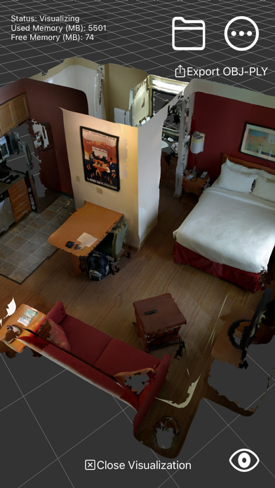
RTAB-Map (Real-Time Appearance-Based Mapping) is an Open Source LiDAR / RGB-D / Stereo Graph-Based SLAM (Simultaneous Localization and Mapping) approach based on an online incremental appearance-based loop closure detector. The loop closure detector uses a bag-of-words approach to determinate how likely a new image comes from a previous location or a new location. When a loop closure hypothesis is accepted, a new constraint is added to the map's graph, then a graph optimizer minimizes the errors in the map in real-time. An optional memory management approach can be used to limit the number of locations used for loop closure detection and graph optimization, so that real-time constraints on large-scale environnements are always respected. ARKit's visual inertial odometry (VIO) is used as the SLAM front-end for RTAB-Map (the SLAM back-end).
* Note that unlike other scanning apps that optimize the map only after mapping, with RTAB-Map you get loop closure detection and map optimization online so you can have a live feedback to know when you have enough constraints in the map for good global optimization before stopping the scan.
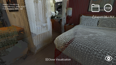
*** 3D reconstruction available only with LiDAR sensor.
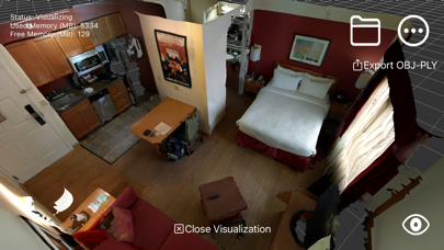
Features: * Online 3D scanning/mapping of the environment. * Online loop closure detection and map correction. * Save in DB format (RTAB-Map desktop and rtabmap_ros format). * Export in PLY, LAS or OBJ. * Multi-session mapping (save and continue later). * Use Apriltags to help finding loop closures in textureless environments. * Mixed AR/VR First-Person in visualization mode. * Raw ARKit data recording (up to 60 Hz!), useful to record long sessions without comprising battery life.
Each subscription will automatically renew 3 days before the expiration date for
the same time period. Subscriptions can be cancelled at any time before the renewal.