

Terrain Navigator Pro
Terrain Navigator Pro is made and published by Trimble Inc. AppBrain is an independent app data site and isn't affiliated with Trimble Inc. The app name, icon, screenshots and description belong to Trimble Inc. and are shown as published on the App Store.
AppBrain's verdict
Established- Rating on App Store
- 2.70
- 20 ratings
- Last updated
- December 23, 2020
It doesn't have enough ratings yet to judge what users think.
Rankings
App Store top chartsApp Store Rankings for Terrain Navigator Pro
Competitors
Similar apps and more from Trimble Inc.Alternatives to Terrain Navigator Pro


More from Trimble Inc.


Releases
Updates seen on the App Store- Version
- 2.3.5
- Launched
- December 2012
No changelog data
User feedback
Ratings and reviews on the App StoreComments on Terrain Navigator Pro for iOS
We don't have enough comments to show example comments. Please check back later.
Technology
Found in the app by AppBrain- Price
- Free
- App size
- 62.4 MB
- Content rating
- Everyone
Technologies used by Terrain Navigator Pro
About the app and developer
About Terrain Navigator Pro
Terrain Navigator Pro is a productivity app developed by Trimble Inc.
What is the rating of Terrain Navigator Pro?
Terrain Navigator Pro is rated 2.70 out of 5 stars, based on 20 ratings.
Is Terrain Navigator Pro free?
Terrain Navigator Pro is free. The app size is 62.40 MB. The latest version available is 2.3.5. The last update was on December 23, 2020.
What are the requirements for Terrain Navigator Pro?
The app has a content rating of Everyone. The app has been available on the App Store since December 2012.
Developer information for Trimble Inc.
Address:
Store listing
By Trimble Inc., from the App Store


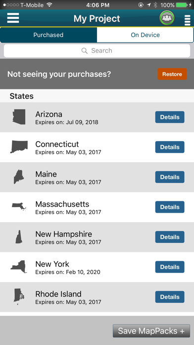
Description by Trimble Inc. Written by the developer, not by AppBrain. Click to read.
TNP serves a professional market, including search and rescue teams, law enforcement, foresters, surveyors, the oil and gas industry, and land managers. This mobile app is ideal for entry-level GIS applications and enables professionals to use the smartphone in their pocket instead of a consumer-grade GPS device.
To activate this app, users need a licensed copy of the Terrain Navigator Pro desktop software version 9.2 or later.
To learn more about TNP, visit the Terrain Navigator Website at www.terrainnavigator.com.
OFFLINE DATA COLLECTION
The TNP mobile app uses the GPS built into the iPhone, so professionals can collect field data in areas without a cellular or data signal. In addition, users can download and store topographic, aerial, and street maps onto the phone for offline use and data display. Your data is stored on your iPhone, so there’s no need to have a network connection.
----------------------------------
TNP CLOUD
Got a Wi-Fi or data connection? Share your data in near real-time with colleagues at the office to streamline project workflows. The TNP app uploads data as it’s collected, so professionals with the same project open in the TNP desktop software can view the field data and collaborate to make accurate, on-the-spot decisions.
----------------------------------
TNP MOBILE APP FEATURES
•Collect field data (markers, tracks, photos, videos, audio clips) in areas without a cellular or data signal.
•Near real-time sync between phone and TNP map software via Wifi or data connection like a 3G network.
•View data on topographic, aerial, and street maps downloaded to phone for offline use. Terrain Navigator Pro offers 1-meter aerial photos for the 48 contiguous United States. The seamless USGS topographic maps are based off 1:24K, 1:100K, 1:250K map scales. Alaska is 1:63K and 1:250K.
•Access a compass and other geo-information such as latitude/longitude, elevation, and direction on phone.
•New Feature for TNP Enterprise customers - team tracking shows where your users are in near real time. Support for team projects which allow organizations to control data users can see
----------------------------------
TNP DESKTOP SOFTWARE
This app syncs to our award-winning Terrain Navigator Pro mapping software, which has been fine-tuned based on more than a decade of feedback from professionals who rely heavily on maps in the field. The TNP software provides access to an easily catalogued collection of USGS/US Forest Service topographic maps, including 1:24,000 (7.5 minute series), 1:100,000 and 1:250,000 scale as well as seamless, 1-meter resolution color aerial photos dating back to 2003, and up to the most recent National Agriculture Imagery Program (NAIP) aerial imagery available. The software supports GIS and CAD export and import, and provides access to advanced mapping tools, including: range rings by time and distance, area fills and line-of-sight height offsets, geo-pins, geo-tips, Public Land Survey System (PLSS), advanced address search, up-to-date street data, and more.
----------------------------------
Notes: Terrain Navigator Pro is designed for your iPhone device. Continued use of GPS running in the background can dramatically decrease battery life.