




AppBrain's verdict
- Last updated
- October 29, 2026
- Size
- 85.8 MB
User feedback
Ratings and reviews on the App StoreComments on TrailTreks: NZ Topo Maps for iOS
We don't have enough comments to show example comments. Please check back later.
Store listing
By Evgeniy Kobyakov, from the App StoreDescription by Evgeniy Kobyakov Written by the developer, not by AppBrain. Click to read.
Free to download and use, with no ads. An optional PLUS subscription adds extras for regular users.
OFFLINE NZ TOPO MAPS
- LINZ Topo50-style raster, vector and aerial maps, plus a classic printed-map look
- Maps save automatically as you browse, so places you've looked at work with no signal
- Download the North Island, the South Island or all of New Zealand before you go, and remove areas to free up storage
DOC HUTS, CAMPSITES & TRACKS
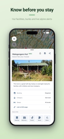
- Every DOC hut, campsite and track on the map, with search
- Facilities, hut booking status and DOC alerts for each one
ALERTS & NOTIFICATIONS
- DOC alerts: get notified when DOC posts a closure or warning for a hut, campsite, track or whole region you're watching
- Severe weather: get MetService severe weather warnings for the regions you care about
LOCATION SHARING
- Start a time-limited session and send the link to family or friends
- Post your position with one tap. They follow along in any browser, with no app or account needed.
- Each update is tiny, so it's built to work on phone-to-satellite plans when there's no mobile coverage
TE ARAROA
- Every Te Araroa section on the map, northbound (NOBO) or southbound (SOBO)
- Tick off sections, track your journey and download sections for offline use
- Turn the next section into a trip plan in one tap
HUNTING & PUBLIC ACCESS
- Public conservation land and recreational hunting permit areas
- Paper roads, walking access easements and bike tracks
- Native bush, scrub, scree and hillshade layers
GPS TRACKING & ROUTES
- Record your route in the background with the screen off
- Choose super accurate, optimised or battery-saving mode
- Draw your own route on the map before you go
- Import GPX files with waypoints, and see an elevation profile with gain, loss and distance for every track
- Sync your tracks across all your devices
TRIP PLANNING & WEATHER
- Trip plans: record where you're going, who's with you and your vehicle details, share them with someone at home, and get a check-in reminder at your expected return time
- 10-day forecasts for 60+ NZ ranges, parks and peaks, and for any track, saved for offline use
SHARE
- Send a track, hut, campsite or marker as a short link. People who open it land straight on it.
- Drop custom markers anywhere and link them to a DOC hut or campsite
TRAILTREKS PLUS (OPTIONAL SUBSCRIPTION)
PLUS is available as a monthly or yearly auto-renewing subscription. It includes unlimited DOC alert watches and weather alert regions, offline hillshade, offline hunting and access layers, dark and high-contrast vector maps, and snap to track. Payment is charged to your Apple ID. Subscriptions renew automatically unless cancelled at least 24 hours before the end of the current period. Manage or cancel in your App Store account settings.
SAFETY NOTE
TrailTreks is not an emergency device. Always carry a personal locator beacon (PLB), leave your intentions with someone you trust, and check conditions with DOC before you go.
NOT A GOVERNMENT APP
TrailTreks is an independent app by a private New Zealand developer. It is not affiliated with, endorsed by or operated by LINZ, the Department of Conservation, MetService, Herenga ā Nuku Aotearoa or any NZ government agency. Map data: LINZ (CC BY 4.0). Huts, tracks and alerts: DOC. Forecasts: MET Norway.
Full features list: https://trailtreks.nz/app
Terms of Use: https://trailtreks.nz/terms
Privacy Policy: https://trailtreks.nz/privacy
Safety and technology
Found in the app by AppBrain- Price
- Free
- App size
- 85.8 MB
- Content rating
- Everyone
Technologies used by TrailTreks: NZ Topo Maps
Releases
Updates seen on the App Store- Version
- 2.75.8
- Launched
- September 2025
No changelog data
Alternatives
Similar apps and more from Evgeniy KobyakovAlternatives to TrailTreks: NZ Topo Maps


Rankings
App Store top chartsApp Store Rankings for TrailTreks: NZ Topo Maps
About the app and developer
About TrailTreks: NZ Topo Maps
TrailTreks: NZ Topo Maps is a navigation app developed by Evgeniy Kobyakov.
User Ratings
The app has no ratings yet.
App Information
TrailTreks: NZ Topo Maps is freely available from the App Store. The app size is 85.78 MB. The latest version available is 2.75.8. The last update was on October 29, 2026.
Technical Requirements
The app has a content rating of Everyone. The app has been available on the App Store since September 2025.
TrailTreks: NZ Topo Maps is made and published by Evgeniy Kobyakov. AppBrain is an independent app data site and isn't affiliated with Evgeniy Kobyakov. The app name, icon, screenshots and description belong to Evgeniy Kobyakov and are shown as published on the App Store.
Developer information for Evgeniy Kobyakov
Address:
Frequently asked questions about TrailTreks: NZ Topo Maps
Is TrailTreks: NZ Topo Maps free?
Yes. TrailTreks: NZ Topo Maps is free on the App Store.
Is TrailTreks: NZ Topo Maps still available?
Yes. TrailTreks: NZ Topo Maps is on the App Store, and the last update we saw was on October 29, 2026.
How large is TrailTreks: NZ Topo Maps?
TrailTreks: NZ Topo Maps is 85.78 MB.
Is TrailTreks: NZ Topo Maps suitable for children?
App Store rates the content of TrailTreks: NZ Topo Maps as suitable for everyone.
Who made TrailTreks: NZ Topo Maps?
TrailTreks: NZ Topo Maps was developed by Evgeniy Kobyakov. It is listed in the navigation category on the App Store.
What are the best alternatives to TrailTreks: NZ Topo Maps?
People looking at TrailTreks: NZ Topo Maps also look at these navigation apps: Trekmate GPX, iHikeGPS NZ : LINZ Topo Maps, GoJa: Japan Trip Planner, Maymont Guide: RVA, Earth 3D - Live Satellite Map.