

Virginia State Roads
Virginia State Roads is made and published by Coderun Technologies Ltd. AppBrain is an independent app data site and isn't affiliated with Coderun Technologies Ltd. The app name, icon, screenshots and description belong to Coderun Technologies Ltd and are shown as published on the App Store.
AppBrain's verdict
Established- Rating on App Store
- 4.00
- 8 ratings
- Last updated
- February 19, 2025
It doesn't have enough ratings yet to judge what users think.
Rankings
App Store top chartsApp Store Rankings for Virginia State Roads
Competitors
Similar apps and more from Coderun Technologies LtdAlternatives to Virginia State Roads








More from Coderun Technologies Ltd


Releases
Updates seen on the App Store- Version
- 2.1
- Launched
- May 2018
No changelog data
User feedback
Ratings and reviews on the App StoreComments on Virginia State Roads for iOS
We don't have enough comments to show example comments. Please check back later.
Technology
Found in the app by AppBrain- Price
- $1.99
- App size
- 3.51 MB
- Content rating
- Everyone
Technologies used by Virginia State Roads
About the app and developer
About Virginia State Roads
Virginia State Roads is a travel app developed by Coderun Technologies Ltd.
User Ratings
Virginia State Roads is rated 4.00 out of 5 stars. The rating is based on 8 ratings.
App Information
Virginia State Roads costs $1.99. The app size is 3.51 MB. The latest version available is 2.1. The last update was on February 19, 2025.
Technical Requirements
The app has a content rating of Everyone. The app has been available on the App Store since May 2018.
Developer information for Coderun Technologies Ltd
Address:
Store listing
By Coderun Technologies Ltd, from the App Store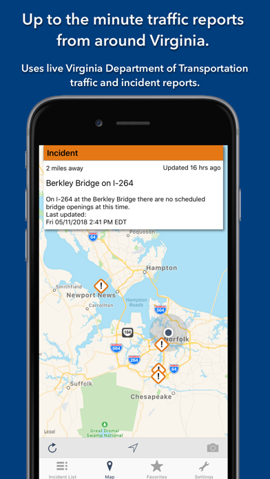

Description by Coderun Technologies Ltd Written by the developer, not by AppBrain. Click to read.
KEY FEATURES:
Live data from The Virginia Department of Transportation (VDOT):
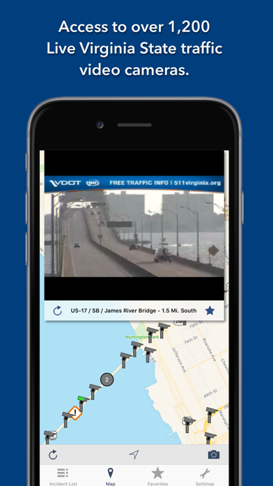
- 1,400+ traffic video cameras covering Virginia State.
- Today screen widget to show at a glance the nearest current traffic incidents
- Optimised for all iPhone and iPad models.
MAP VIEW
- Shows current incidents and traffic cams
- Each incident is color coded as well as being represented by an icon showing the incident type.
- Clicking on an incident displays more detail right there on the map.
- The map view can also show live traffic camera videos.
LIST VIEW
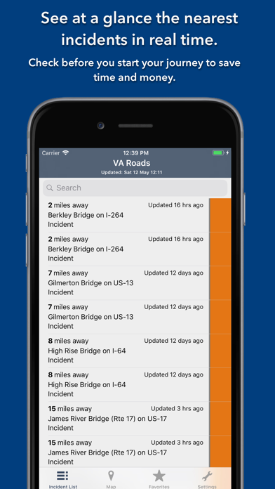
- Shows current incidents in order of distance from your current location (closest incidents are shown first).
- Each incident is color-coded to indicate the severity of the delay.
- You can quickly see the distance the incident is from you, the road name and the type of incident.
- The detail view shows the description together with a map showing the location.
- Full search functionality, works across both the list and map views.
TRAFFIC CAM FAVORITES
- Save your favorite cameras for quick access to see how clear/congested your usual routes are.
TODAY WIDGET
- Shows at a glance the nearest current traffic incidents without launching the app.
PERSONALISE
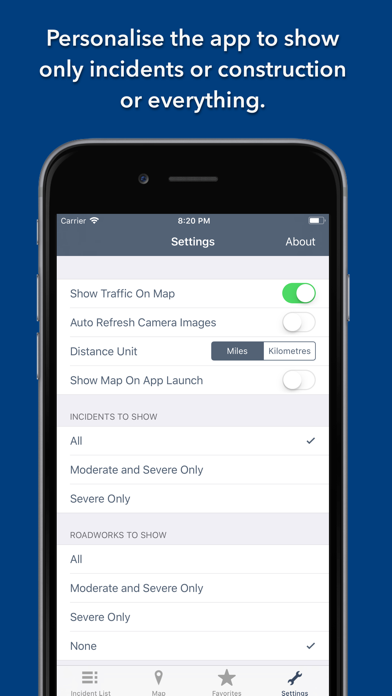
- Toggle traffic information on the map.
- Toggle always show map on app launch.
- Toggle construction on/off.
- You can configure which incidents are displayed according to the severity of the delay caused.
- Miles or KM setting.
CONTACT
- Email me for feature requests/bug reports etc. I would love to hear from you!
Data courtesy of The Virginia Department of Transportation (VDOT).