AppBrain
|
Apps
Apps
Apps being viewed right now
Trending apps today
Most popular apps
All-time most downloaded apps
Top rated apps
Statistics
Docs
Developers
Sign up
Log in
Android Apps
>
Maps & Navigation
>
Paid
Category
Maps & Navigation
Sort by
Trending
Recent downloads
All-time downloads
Top rated
Popular in
Filter by
Off
Free
Paid
New
Updated
Price Reduced
No ads
Page 10 of the
popular Paid Maps & Navigation Apps for Android in Denmark
What Street?
Applorium Ltd
Welcome to What Street? – the ultimate street name identification app that tells you exactly where you are! Have you ever found yourself lost in a new city, wandering aimlessly down unfamiliar…
$1.99
0.0
10+ downloads
|
Maps & Navigation
0.0
$1.99
Applorium Ltd
10+ downloads
TRANSPORTATION
What Street?
Welcome to What Street? – the ultimate street name identification app that tells you exactly where you are! Have…
Manhattan Fallout Shelters Map – Click to show
Manhattan Fallout Shelters Map
GeoPOI LLC
Navigate an interactive map of nearly 25,000 points representing the locations of surveyed nuclear fallout shelters across the entirety of Manhattan Island in New York City. This includes all of the …
$3.99
0.0
1+ downloads
|
Maps & Navigation
0.0
$3.99
GeoPOI LLC
1+ downloads
TRANSPORTATION
Manhattan Fallout Shelters Map
Navigate an interactive map of nearly 25,000 points representing the locations of surveyed nuclear fallout shelters acr…
Wagitaler Sihl Klontaler Chart – Click to show
Wagitaler Sihl Klontaler Chart
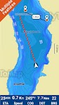
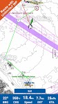
FLYTOMAP INC
Flytomap is a valid and interesting alternative, Featured on the Deck Featured on Geomedia Worldwide Marine and Outdoor Maps available when connected, thanks to viewer.flytomap.com Worldwide Satelli…
$3.99
0.0
5+ downloads
|
Maps & Navigation
0.0
$3.99
FLYTOMAP INC
5+ downloads
TRANSPORTATION
Wagitaler Sihl Klontaler Chart
Flytomap is a valid and interesting alternative, Featured on the Deck Featured on Geomedia Worldwide Marine and Outdoo…
Georgia S to N Carolina Charts – Click to show
Georgia S to N Carolina Charts
FLYTOMAP INC
Flytomap is a valid and interesting alternative, Featured on the Deck Featured on Geomedia Worldwide Marine and Outdoor Maps available when connected, thanks to viewer.flytomap.com Worldwide Satellit…
$3.99
0.0
10+ downloads
|
Maps & Navigation
0.0
$3.99
FLYTOMAP INC
10+ downloads
TRANSPORTATION
Georgia S to N Carolina Charts
Flytomap is a valid and interesting alternative, Featured on the Deck Featured on Geomedia Worldwide Marine and Outdoor…
No BS GPS
Crushtronic LLC
No BS GPS is a standalone Wear OS watch app (no phone needed) that simply just shows your current GPS coordinates in a variety of formats in large print. Coordinate formats available include: Decima…
$0.99
0.0
50+ downloads
|
Maps & Navigation
0.0
$0.99
Crushtronic LLC
50+ downloads
TRANSPORTATION
No BS GPS
No BS GPS is a standalone Wear OS watch app (no phone needed) that simply just shows your current GPS coordinates in a …
Lake of the Ozarks GPS Charts – Click to show
Lake of the Ozarks GPS Charts
FLYTOMAP INC
Flytomap is a valid and interesting alternative, Featured on the Deck Featured on Geomedia Worldwide Marine and Outdoor Maps available when connected, thanks to viewer.flytomap.com Worldwide Satelli…
$3.99
0.0
100+ downloads
|
Maps & Navigation
0.0
$3.99
FLYTOMAP INC
100+ downloads
TRANSPORTATION
Lake of the Ozarks GPS Charts
Flytomap is a valid and interesting alternative, Featured on the Deck Featured on Geomedia Worldwide Marine and Outdoo…
Speedometer
Mykola Drozd
Good and easy to use speedometer, pedometer, route tracker. Convenient for sports, fitness, hiking, traveling and other purposes when you need to know about your speed and location. Allows you to sa…
$1.49
0.0
10+ downloads
|
Maps & Navigation
0.0
$1.49
Mykola Drozd
10+ downloads
TRANSPORTATION
Speedometer
Good and easy to use speedometer, pedometer, route tracker. Convenient for sports, fitness, hiking, traveling and other…
Forager's Buddy Pro Key
G.H IT Services
This product is the Activation Code of Forager's Buddy. Once purchased, you can upgrade Forager's Buddy Free version to Forager's Buddy Pro version. You must have Forager's Buddy Free Edition insta…
$2.99
4.4
1,000+ downloads
|
Maps & Navigation
4.4
$2.99
G.H IT Services
1,000+ downloads
TRANSPORTATION
Forager's Buddy Pro Key
This product is the Activation Code of Forager's Buddy. Once purchased, you can upgrade Forager's Buddy Free version to…
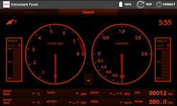
OBD Info-san!
ganchi
note: The text translates the original Japanese with a Google translation. [Operation check in the trial version! 】 Although this application is charged, there is a possibility that it will not oper…
$4.99
0.0
5,000+ downloads
|
Maps & Navigation
0.0
$4.99
ganchi
5,000+ downloads
TRANSPORTATION
OBD Info-san!
note: The text translates the original Japanese with a Google translation. [Operation check in the trial version! 】 Al…
Helsinki GPS Map Navigator – Click to show
Helsinki GPS Map Navigator
FLYTOMAP INC
Flytomap is a valid and interesting alternative, Featured on the Deck Featured on Geomedia Worldwide Marine and Outdoor Maps available when connected, thanks to viewer.flytomap.com Worldwide Satelli…
$3.99
0.0
5+ downloads
|
Maps & Navigation
0.0
$3.99
FLYTOMAP INC
5+ downloads
TRANSPORTATION
Helsinki GPS Map Navigator
Flytomap is a valid and interesting alternative, Featured on the Deck Featured on Geomedia Worldwide Marine and Outdoo…
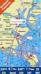
Mallorca Menorca Offline Chart – Click to show
Mallorca Menorca Offline Chart
MAPITECH LTD
MapiTech launches on the market the best official up-to-date RNC (raster) combined with S57 nautical charts (digital): marinas, wrecks, fishing spots, boat ramps, POI. This app displays seamlessly …
$4.99
0.0
1+ downloads
|
Maps & Navigation
0.0
$4.99
MAPITECH LTD
1+ downloads
TRANSPORTATION
Mallorca Menorca Offline Chart
MapiTech launches on the market the best official up-to-date RNC (raster) combined with S57 nautical charts (digital):…
Costa Brava GPS Map Navigator – Click to show
Costa Brava GPS Map Navigator
FLYTOMAP INC
Flytomap is a valid and interesting alternative, Featured on the Deck Featured on Geomedia Worldwide Marine and Outdoor Maps available when connected, thanks to viewer.flytomap.com Worldwide Satellit…
$3.99
0.0
5+ downloads
|
Maps & Navigation
0.0
$3.99
FLYTOMAP INC
5+ downloads
TRANSPORTATION
Costa Brava GPS Map Navigator
Flytomap is a valid and interesting alternative, Featured on the Deck Featured on Geomedia Worldwide Marine and Outdoor…
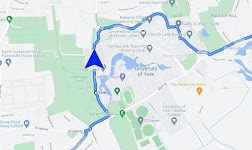
Satnav Cycle Routes – York – Click to show
Satnav Cycle Routes – York
Ian Lochhead
3 Satnav Cycle Routes around York. 1. Around York - 19.5 miles 2. York to Stamford Bridge - 28.3 miles 3. York to Tadcaster - 21.3 miles Satnav Cycle Routes around York using cycle paths and roads. …
$0.99
0.0
0+ downloads
|
Maps & Navigation
0.0
$0.99
Ian Lochhead
0+ downloads
TRANSPORTATION
Satnav Cycle Routes – York
3 Satnav Cycle Routes around York. 1. Around York - 19.5 miles 2. York to Stamford Bridge - 28.3 miles 3. York to Tadca…
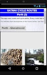
Satnav Cycle Routes – Perth(2) – Click to show
Satnav Cycle Routes – Perth(2)
Ian Lochhead
Perth - Glenalmond. 35 miles Perth - Crieff. 38 miles Perth - Milnathort. 38 miles Satnav Cycle Routes around Perth using cycle paths and roads. Every route has turn-by-turn navigation with voice in…
$0.99
0.0
0+ downloads
|
Maps & Navigation
0.0
$0.99
Ian Lochhead
0+ downloads
TRANSPORTATION
Satnav Cycle Routes – Perth(2)
Perth - Glenalmond. 35 miles Perth - Crieff. 38 miles Perth - Milnathort. 38 miles Satnav Cycle Routes around Perth us…
Satnav CycleRoutes–Dunfermline – Click to show
Satnav CycleRoutes–Dunfermline
Ian Lochhead
Dunfermline - Kincardine. 28.6 miles Dunfermline - Limekilns. 14.4 miles Satnav Cycle Routes around Dunfermline using cycle paths and roads. Every route has turn-by-turn navigation with voice instru…
$0.99
0.0
0+ downloads
|
Maps & Navigation
0.0
$0.99
Ian Lochhead
0+ downloads
TRANSPORTATION
Satnav CycleRoutes–Dunfermline
Dunfermline - Kincardine. 28.6 miles Dunfermline - Limekilns. 14.4 miles Satnav Cycle Routes around Dunfermline using …
Satnav Cycle Routes – Falkirk – Click to show
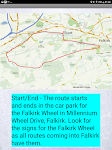
Satnav Cycle Routes – Falkirk
Ian Lochhead
Around the Falkirk Wheel. 12.5 miles Falkirk - Avonbridge. 24 miles Falkirk - Fannyside Loch. 20 miles Falkirk Wheel & Helix Park. 12 miles Satnav Cycle Routes around Falkirk using cycle paths a…
$0.99
0.0
1+ downloads
|
Maps & Navigation
0.0
$0.99
Ian Lochhead
1+ downloads
TRANSPORTATION
Satnav Cycle Routes – Falkirk
Around the Falkirk Wheel. 12.5 miles Falkirk - Avonbridge. 24 miles Falkirk - Fannyside Loch. 20 miles Falkirk Wheel &a…
Satnav Cycle Routes - Dumfries – Click to show
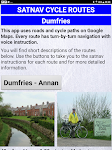
Satnav Cycle Routes - Dumfries
Ian Lochhead
Dumfries - Annan. 43 miles Dumfries - Lochmabon. 40 miles Dumfries - New Abbey. 27 miles 3 Satnav Cycle Routes around Dumfries using cycle paths and roads on Google Maps. Every route has turn-by-tur…
$0.99
0.0
0+ downloads
|
Maps & Navigation
0.0
$0.99
Ian Lochhead
0+ downloads
TRANSPORTATION
Satnav Cycle Routes - Dumfries
Dumfries - Annan. 43 miles Dumfries - Lochmabon. 40 miles Dumfries - New Abbey. 27 miles 3 Satnav Cycle Routes around …
Satnav Cycle Routes –Inverness – Click to show
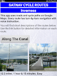
Satnav Cycle Routes –Inverness
Ian Lochhead
Satnav Cycle Routes around Inverness using cycle paths and quiet roads. Every route has turn-by-turn navigation with voice instruction. Enjoy the benefits of cycling a whole route by following Sat Na…
$0.99
0.0
0+ downloads
|
Maps & Navigation
0.0
$0.99
Ian Lochhead
0+ downloads
TRANSPORTATION
Satnav Cycle Routes –Inverness
Satnav Cycle Routes around Inverness using cycle paths and quiet roads. Every route has turn-by-turn navigation with vo…
Satnav Cycle Routes-Newcastle1 – Click to show
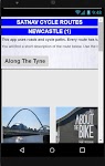
Satnav Cycle Routes-Newcastle1
Ian Lochhead
1. Along the Tyne - 15 miles 2. Newcastle to Gateshead - 23.5 miles 3. Newcastle to Sunderland - 39 miles Satnav Cycle Routes around Newcastle using cycle paths and roads. Every route has turn-by-tu…
$0.99
0.0
0+ downloads
|
Maps & Navigation
0.0
$0.99
Ian Lochhead
0+ downloads
TRANSPORTATION
Satnav Cycle Routes-Newcastle1
1. Along the Tyne - 15 miles 2. Newcastle to Gateshead - 23.5 miles 3. Newcastle to Sunderland - 39 miles Satnav Cycle…
Satnav Cycle Routes -Dundee(2) – Click to show
Satnav Cycle Routes -Dundee(2)
Ian Lochhead
Dundee - Piperdam. 23 miles Dundee - Carnoustie. 31 miles Satnav Cycle Routes around Dundee using cycle paths and roads. Every route has turn-by-turn navigation with voice instruction. Enjoy the ben…
$0.99
0.0
0+ downloads
|
Maps & Navigation
0.0
$0.99
Ian Lochhead
0+ downloads
TRANSPORTATION
Satnav Cycle Routes -Dundee(2)
Dundee - Piperdam. 23 miles Dundee - Carnoustie. 31 miles Satnav Cycle Routes around Dundee using cycle paths and road…
United States
United Kingdom
Germany
Norway
Sweden
Australia
Netherlands
Italy
Denmark
Hong Kong
Brazil
France
Canada
Spain
Portugal
South Korea
Japan
Poland
Hungary
India
Finland
Thailand
Russia
General
Overall
Applications
Games
Join AppBrain
Join AppBrain to get app recommendations
Apps
Art & Design
Auto & Vehicles
Beauty
Books & Reference
Business
Comics
Communication
Dating
Education
Entertainment
Events
Finance
Food & Drink
Health & Fitness
House & Home
Libraries & Demo
Lifestyle
Maps & Navigation
Medical
Music & Audio
News & Magazines
Parenting
Personalization
Photography
Productivity
Shopping
Social
Sports
Tools
Travel & Local
Video Players & Editors
Weather
Games
Action
Adventure
Arcade
Board
Card
Casino
Casual
Educational
Music
Puzzle
Racing
Role Playing
Simulation
Sports Games
Strategy
Trivia
Word