Android Apps
>
Maps & Navigation
> Paid
Category
Maps & Navigation
Sort by
Trending
Recent downloads
All-time downloads
Top rated
Popular in
Filter by
Off
Free
Paid
New
Updated
Price Reduced
No ads
Page 5 of the popular Paid Maps & Navigation Apps for Android in the United Kingdom
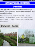
Satnav Cycle Routes - Dumfries
Ian Lochhead

Dumfries - Annan. 43 miles
Dumfries - Lochmabon. 40 miles
Dumfries - New Abbey. 27 miles
3 Satnav Cycle Routes around Dumfries using cycle paths and roads on Google Maps. Every route has turn-by-tur…


$0.99
0.0
0+ downloads
|
Maps & Navigation
0.0
$0.99
Ian Lochhead
0+ downloads
TRANSPORTATION
0+ downloads
TRANSPORTATION
Satnav Cycle Routes - Dumfries
Dumfries - Annan. 43 miles
Dumfries - Lochmabon. 40 miles
Dumfries - New Abbey. 27 miles
3 Satnav Cycle Routes around …
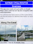
Satnav Cycle Routes –Inverness
Ian Lochhead

Satnav Cycle Routes around Inverness using cycle paths and quiet roads. Every route has turn-by-turn navigation with voice instruction. Enjoy the benefits of cycling a whole route by following Sat Na…


$0.99
0.0
0+ downloads
|
Maps & Navigation
0.0
$0.99
Ian Lochhead
0+ downloads
TRANSPORTATION
0+ downloads
TRANSPORTATION
Satnav Cycle Routes –Inverness
Satnav Cycle Routes around Inverness using cycle paths and quiet roads. Every route has turn-by-turn navigation with vo…
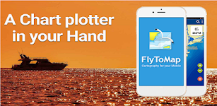
Mille Lacs Gps Map Navigator
FLYTOMAP INC

Flytomap is a valid and interesting alternative,
Featured on the Deck
Featured on Geomedia
Worldwide Marine and Outdoor Maps available when connected, thanks to viewer.flytomap.com
Worldwide Satelli…


$3.99
0.0
50+ downloads
|
Maps & Navigation
0.0
$3.99
FLYTOMAP INC
50+ downloads
TRANSPORTATION
50+ downloads
TRANSPORTATION
Mille Lacs Gps Map Navigator
Flytomap is a valid and interesting alternative,
Featured on the Deck
Featured on Geomedia
Worldwide Marine and Outdoo…
Channel Islands Offline Map
XDivide Geospatial

Designed with simplicity in mind, this app offers an intuitive user interface that enables you to quickly and easily find information about surroundings, without any prior technical knowledge or expe…


$0.99
0.0
0+ downloads
|
Maps & Navigation
0.0
$0.99
XDivide Geospatial
0+ downloads
TRANSPORTATION
0+ downloads
TRANSPORTATION
Channel Islands Offline Map
Designed with simplicity in mind, this app offers an intuitive user interface that enables you to quickly and easily fi…
Kärnten Lakes - Austria Charts
MAPITECH LTD

MapiTech launches on the market the best official up-to-date combined with S57 nautical charts (digital): marinas, wrecks, fishing spots, boat ramps, POI.
Lakes in this App : Aichwaldsee,AfritzerSe…


$4.99
0.0
5+ downloads
|
Maps & Navigation
0.0
$4.99
MAPITECH LTD
5+ downloads
TRANSPORTATION
5+ downloads
TRANSPORTATION
Kärnten Lakes - Austria Charts
MapiTech launches on the market the best official up-to-date combined with S57 nautical charts (digital): marinas, wre…
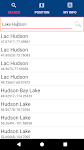
Lake Hudson GPS Map Navigator
FLYTOMAP INC

Flytomap is a valid and interesting alternative,
Featured on the Deck
Featured on Geomedia
Worldwide Marine and Outdoor Maps available when connected, thanks to viewer.flytomap.com
Worldwide Satelli…

$3.99
0.0
0+ downloads
|
Maps & Navigation
0.0
$3.99
FLYTOMAP INC
0+ downloads
TRANSPORTATION
0+ downloads
TRANSPORTATION
Lake Hudson GPS Map Navigator
Flytomap is a valid and interesting alternative,
Featured on the Deck
Featured on Geomedia
Worldwide Marine and Outdoo…
Smith Mountain Lake GPS Charts
FLYTOMAP INC

Flytomap is a valid and interesting alternative,
Featured on the Deck
Featured on Geomedia
Worldwide Marine and Outdoor Maps available when connected, thanks to viewer.flytomap.com
Worldwide Satellit…


$3.99
0.0
50+ downloads
|
Maps & Navigation
0.0
$3.99
FLYTOMAP INC
50+ downloads
TRANSPORTATION
50+ downloads
TRANSPORTATION
Smith Mountain Lake GPS Charts
Flytomap is a valid and interesting alternative,
Featured on the Deck
Featured on Geomedia
Worldwide Marine and Outdoor…
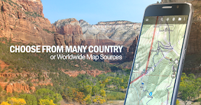
BackCountry Navigator GPS PRO
CritterMap Software LLC

Download topo maps for an offline outdoor navigator! Use your phone or tablet as an offroad topo mapping handheld GPS with the bestselling outdoor navigation app for Android! Explore beyond cell cove…


$14.99
3.6
100,000+ downloads
|
Maps & Navigation
3.6
$14.99
CritterMap Software LLC
100,000+ downloads
TRANSPORTATION
100,000+ downloads
TRANSPORTATION
BackCountry Navigator GPS PRO
Download topo maps for an offline outdoor navigator! Use your phone or tablet as an offroad topo mapping handheld GPS w…
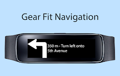
Gear Fit Navigation
SmartWatch Studios

This application displays Google Navigation instructions on your Samsung Gear Fit 1 smartwatch. (Not compatible with Gear Fit2!)
Note:
- Supports horizontal and vertical layout
- Additional to the …


$1.99
3.3
10,000+ downloads
|
Maps & Navigation
3.3
$1.99
SmartWatch Studios
10,000+ downloads
TRANSPORTATION
10,000+ downloads
TRANSPORTATION
Gear Fit Navigation
This application displays Google Navigation instructions on your Samsung Gear Fit 1 smartwatch. (Not compatible with Ge…
Guadalupe Mountain Offline Map
XDivide Geospatial

Designed with simplicity in mind, this app offers an intuitive user interface that enables you to quickly and easily find information about surroundings, without any prior technical knowledge or expe…


$0.99
0.0
1+ downloads
|
Maps & Navigation
0.0
$0.99
XDivide Geospatial
1+ downloads
TRANSPORTATION
1+ downloads
TRANSPORTATION
Guadalupe Mountain Offline Map
Designed with simplicity in mind, this app offers an intuitive user interface that enables you to quickly and easily fi…
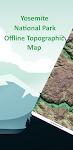
Yosemite Offline Topo Map
XDivide Geospatial

Designed with simplicity in mind, this app offers an intuitive user interface that enables you to quickly and easily find information about surroundings, without any prior technical knowledge or expe…

$2.99
0.0
0+ downloads
|
Maps & Navigation
0.0
$2.99
XDivide Geospatial
0+ downloads
TRANSPORTATION
0+ downloads
TRANSPORTATION
Yosemite Offline Topo Map
Designed with simplicity in mind, this app offers an intuitive user interface that enables you to quickly and easily fi…
Blue Lake IOWA GPS Charts
FLYTOMAP

Flytomap is a valid and interesting alternative, Benetti Yachts
Featured on the Deck
Featured on Geomedia
Worldwide Marine and Outdoor Maps available when connected, thanks to viewer.flytomap.com
Wor…


$2.99
0.0
1+ downloads
|
Maps & Navigation
0.0
$2.99
FLYTOMAP
1+ downloads
TRANSPORTATION
1+ downloads
TRANSPORTATION
Blue Lake IOWA GPS Charts
Flytomap is a valid and interesting alternative, Benetti Yachts
Featured on the Deck
Featured on Geomedia
Worldwide Mar…
Region Of Murcia GPS Navigator
FLYTOMAP INC

Flytomap is a valid and interesting alternative,
Worldwide Marine and Outdoor Maps available when connected, thanks to viewer.flytomap.com
Worldwide Satellite images overlay on charts
Worldwide Terr…


$3.99
0.0
1+ downloads
|
Maps & Navigation
0.0
$3.99
FLYTOMAP INC
1+ downloads
TRANSPORTATION
1+ downloads
TRANSPORTATION
Region Of Murcia GPS Navigator
Flytomap is a valid and interesting alternative,
Worldwide Marine and Outdoor Maps available when connected, thanks to …
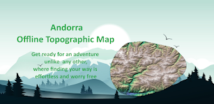
Andorra Offline Topo Map
XDivide Geospatial

Designed with simplicity in mind, this app offers an intuitive user interface that enables you to quickly and easily find information about surroundings, without any prior technical knowledge or expe…

$3.49
0.0
1+ downloads
|
Maps & Navigation
0.0
$3.49
XDivide Geospatial
1+ downloads
TRANSPORTATION
1+ downloads
TRANSPORTATION
Andorra Offline Topo Map
Designed with simplicity in mind, this app offers an intuitive user interface that enables you to quickly and easily fi…
Boating Sydney Nautical Charts
FLYTOMAP INC

Flytomap is a valid and interesting alternative,
Featured on Geomedia
Worldwide Marine and Outdoor Maps available when connected, thanks to viewer.flytomap.com
Worldwide Satellite images overlay on …


$3.99
0.0
10+ downloads
|
Maps & Navigation
0.0
$3.99
FLYTOMAP INC
10+ downloads
TRANSPORTATION
10+ downloads
TRANSPORTATION
Boating Sydney Nautical Charts
Flytomap is a valid and interesting alternative,
Featured on Geomedia
Worldwide Marine and Outdoor Maps available when…
Guadeloupe Offline GPS Charts
MAPITECH LTD

MapiTech launches on the market the best official up-to-date RNC (raster) combined with S57 nautical charts (digital): marinas, wrecks, fishing spots, boat ramps, POI.
This app displays seamlessly …


$4.99
0.0
1+ downloads
|
Maps & Navigation
0.0
$4.99
MAPITECH LTD
1+ downloads
TRANSPORTATION
1+ downloads
TRANSPORTATION
Guadeloupe Offline GPS Charts
MapiTech launches on the market the best official up-to-date RNC (raster) combined with S57 nautical charts (digital):…
France Mediterranean GPS Chart
FLYTOMAP INC

Flytomap is a valid and interesting alternative,
Worldwide Marine and Outdoor Maps available when connected, thanks to viewer.flytomap.com
Worldwide Satellite images overlay on charts
Worldwide Terr…


$4.99
0.0
10+ downloads
|
Maps & Navigation
0.0
$4.99
FLYTOMAP INC
10+ downloads
TRANSPORTATION
10+ downloads
TRANSPORTATION
France Mediterranean GPS Chart
Flytomap is a valid and interesting alternative,
Worldwide Marine and Outdoor Maps available when connected, thanks to …
UTM Grid Ref Compass
Mike Irving

Never be lost again! Find out your current UTM Grid Reference Map location anywhere in the world.
UTM refers to the Universal Transverse Mercator geographic coordinate system.
Your current Compass …


$0.99
0.0
100+ downloads
|
Maps & Navigation
0.0
$0.99
Mike Irving
100+ downloads
TRANSPORTATION
100+ downloads
TRANSPORTATION
UTM Grid Ref Compass
Never be lost again! Find out your current UTM Grid Reference Map location anywhere in the world.
UTM refers to the Un…
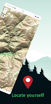
North York Moors Outdoor Map P
jonshutt

An offline map of the North York Moors National Park in England, ideal for hiking, running, mountain biking / cycling. Being offline means unlike other map apps, you don't need a signal to access det…


$1.99
0.0
50+ downloads
|
Maps & Navigation
0.0
$1.99
jonshutt
50+ downloads
TRANSPORTATION
50+ downloads
TRANSPORTATION
North York Moors Outdoor Map P
An offline map of the North York Moors National Park in England, ideal for hiking, running, mountain biking / cycling. …
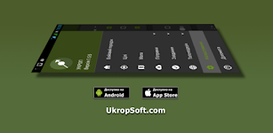
Ukrop
UkropSoft

“UKROP” is intended for calculating target data by artillery units taking into account topographic, meteorological and ballistic training. Suitable for professional work of all military b…


$5.00
0.0
10,000+ downloads
|
Maps & Navigation
0.0
$5.00
UkropSoft
10,000+ downloads
TRANSPORTATION
10,000+ downloads
TRANSPORTATION
Ukrop
“UKROP” is intended for calculating target data by artillery units taking into account topographic, meteoro…

More apps
Android Statistics
About AppBrain
© 2010-2024 - AppBrain