AppBrain
|
Apps
Apps
Apps being viewed right now
Trending apps today
Most popular apps
All-time most downloaded apps
Top rated apps
Statistics
Docs
Developers
Sign up
Log in
Android Apps
>
Maps & Navigation
>
Paid
Category
Maps & Navigation
Sort by
Trending
Recent downloads
All-time downloads
Top rated
Popular in
Filter by
Off
Free
Paid
New
Updated
Price Reduced
No ads
Page 10 of the
recently popular Paid Maps & Navigation Apps for Android
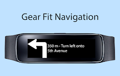
Gear Fit Navigation
SmartWatch Studios
This application displays Google Navigation instructions on your Samsung Gear Fit 1 smartwatch. (Not compatible with Gear Fit2!) Note: - Supports horizontal and vertical layout - Additional to the …
$1.99
3.3
10,000+ downloads
|
Maps & Navigation
3.3
$1.99
SmartWatch Studios
10,000+ downloads
TRANSPORTATION
Gear Fit Navigation
This application displays Google Navigation instructions on your Samsung Gear Fit 1 smartwatch. (Not compatible with Ge…
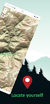
Guadalupe Mountain Offline Map – Click to show
Guadalupe Mountain Offline Map
XDivide Geospatial
Designed with simplicity in mind, this app offers an intuitive user interface that enables you to quickly and easily find information about surroundings, without any prior technical knowledge or expe…
$0.99
0.0
1+ downloads
|
Maps & Navigation
0.0
$0.99
XDivide Geospatial
1+ downloads
TRANSPORTATION
Guadalupe Mountain Offline Map
Designed with simplicity in mind, this app offers an intuitive user interface that enables you to quickly and easily fi…
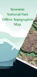
Yosemite Offline Topo Map – Click to show
Yosemite Offline Topo Map
XDivide Geospatial
Designed with simplicity in mind, this app offers an intuitive user interface that enables you to quickly and easily find information about surroundings, without any prior technical knowledge or expe…
$2.99
0.0
0+ downloads
|
Maps & Navigation
0.0
$2.99
XDivide Geospatial
0+ downloads
TRANSPORTATION
Yosemite Offline Topo Map
Designed with simplicity in mind, this app offers an intuitive user interface that enables you to quickly and easily fi…
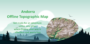
Andorra Offline Topo Map – Click to show
Andorra Offline Topo Map
XDivide Geospatial
Designed with simplicity in mind, this app offers an intuitive user interface that enables you to quickly and easily find information about surroundings, without any prior technical knowledge or expe…
$3.49
0.0
1+ downloads
|
Maps & Navigation
0.0
$3.49
XDivide Geospatial
1+ downloads
TRANSPORTATION
Andorra Offline Topo Map
Designed with simplicity in mind, this app offers an intuitive user interface that enables you to quickly and easily fi…
UTM Grid Ref Compass
Mike Irving
Never be lost again! Find out your current UTM Grid Reference Map location anywhere in the world. UTM refers to the Universal Transverse Mercator geographic coordinate system. Your current Compass …
$0.99
0.0
100+ downloads
|
Maps & Navigation
0.0
$0.99
Mike Irving
100+ downloads
TRANSPORTATION
UTM Grid Ref Compass
Never be lost again! Find out your current UTM Grid Reference Map location anywhere in the world. UTM refers to the Un…
Satnav CycleRoutes–Dunfermline – Click to show
Satnav CycleRoutes–Dunfermline
Ian Lochhead
Dunfermline - Kincardine. 28.6 miles Dunfermline - Limekilns. 14.4 miles Satnav Cycle Routes around Dunfermline using cycle paths and roads. Every route has turn-by-turn navigation with voice instru…
$0.99
0.0
0+ downloads
|
Maps & Navigation
0.0
$0.99
Ian Lochhead
0+ downloads
TRANSPORTATION
Satnav CycleRoutes–Dunfermline
Dunfermline - Kincardine. 28.6 miles Dunfermline - Limekilns. 14.4 miles Satnav Cycle Routes around Dunfermline using …
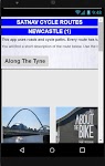
Satnav Cycle Routes-Newcastle1 – Click to show
Satnav Cycle Routes-Newcastle1
Ian Lochhead
1. Along the Tyne - 15 miles 2. Newcastle to Gateshead - 23.5 miles 3. Newcastle to Sunderland - 39 miles Satnav Cycle Routes around Newcastle using cycle paths and roads. Every route has turn-by-tu…
$0.99
0.0
0+ downloads
|
Maps & Navigation
0.0
$0.99
Ian Lochhead
0+ downloads
TRANSPORTATION
Satnav Cycle Routes-Newcastle1
1. Along the Tyne - 15 miles 2. Newcastle to Gateshead - 23.5 miles 3. Newcastle to Sunderland - 39 miles Satnav Cycle…
Car Radar Premium CarFinder
Torsten Hoffmann
That was yesterday: You are in a strange city or hiking in an unfamiliar environment. Suddenly you're wondering ... : - Where is my car or bike? - How do I get back to the train station, bus statio…
$1.99
0.0
1+ downloads
|
Maps & Navigation
0.0
$1.99
Torsten Hoffmann
1+ downloads
TRANSPORTATION
Car Radar Premium CarFinder
That was yesterday: You are in a strange city or hiking in an unfamiliar environment. Suddenly you're wondering ... : …
Places for campers – Click to show
Places for campers
VanLife
Application for camper users and others. While driving, it application notifies You about approaching a camper sites. Maybe it's worth staying at a local small campsite rather than squeezing in la…
$0.63
0.0
10+ downloads
|
Maps & Navigation
0.0
$0.63
VanLife
10+ downloads
TRANSPORTATION
Places for campers
Application for camper users and others. While driving, it application notifies You about approaching a camper sites.…
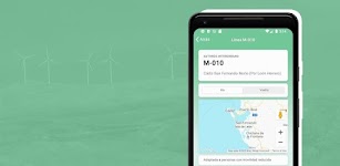
DronES
Reporting Estándar S.L.
En la app dronES hemos combinado dos aplicaciones en una. Busca en el mapa la zona donde vas a volar o usa tus coordenadas actuales. Consulta las restricciones al vuelo usando los mismos servicios qu…
$5.49
0.0
100+ downloads
|
Maps & Navigation
0.0
$5.49
Reporting Estándar S.L.
100+ downloads
TRANSPORTATION
DronES
En la app dronES hemos combinado dos aplicaciones en una. Busca en el mapa la zona donde vas a volar o usa tus coordena…
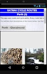
Satnav Cycle Routes – Perth(2) – Click to show
Satnav Cycle Routes – Perth(2)
Ian Lochhead
Perth - Glenalmond. 35 miles Perth - Crieff. 38 miles Perth - Milnathort. 38 miles Satnav Cycle Routes around Perth using cycle paths and roads. Every route has turn-by-turn navigation with voice in…
$0.99
0.0
0+ downloads
|
Maps & Navigation
0.0
$0.99
Ian Lochhead
0+ downloads
TRANSPORTATION
Satnav Cycle Routes – Perth(2)
Perth - Glenalmond. 35 miles Perth - Crieff. 38 miles Perth - Milnathort. 38 miles Satnav Cycle Routes around Perth us…
Congaree Offline Topo Map – Click to show
Congaree Offline Topo Map
XDivide Geospatial
Designed with simplicity in mind, this app offers an intuitive user interface that enables you to quickly and easily find information about surroundings, without any prior technical knowledge or expe…
$0.99
0.0
0+ downloads
|
Maps & Navigation
0.0
$0.99
XDivide Geospatial
0+ downloads
TRANSPORTATION
Congaree Offline Topo Map
Designed with simplicity in mind, this app offers an intuitive user interface that enables you to quickly and easily fi…
Badger Lake - IOWA GPS Map – Click to show
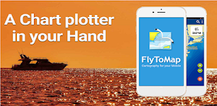
Badger Lake - IOWA GPS Map
FLYTOMAP
Flytomap is a valid and interesting alternative, Benetti Yachts Featured on the Deck Featured on Geomedia Worldwide Marine and Outdoor Maps available when connected, thanks to viewer.flytomap.com Wor…
$2.99
0.0
1+ downloads
|
Maps & Navigation
0.0
$2.99
FLYTOMAP
1+ downloads
TRANSPORTATION
Badger Lake - IOWA GPS Map
Flytomap is a valid and interesting alternative, Benetti Yachts Featured on the Deck Featured on Geomedia Worldwide Mar…
Transportes Andalucía PRO
Fran Caballero Software
AVAILABLE ON ENGLISH. Enhance your journeys across Andalusia (Andalucía, Spain) with our public transportation app. Instantly access updated schedules for buses, trains, metro, and boats acro…
$3.49
0.0
1+ downloads
|
Maps & Navigation
0.0
$3.49
Fran Caballero Software
1+ downloads
TRANSPORTATION
Transportes Andalucía PRO
AVAILABLE ON ENGLISH. Enhance your journeys across Andalusia (Andalucía, Spain) with our public transportation …
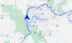
Satnav Cycle Routes – York – Click to show
Satnav Cycle Routes – York
Ian Lochhead
3 Satnav Cycle Routes around York. 1. Around York - 19.5 miles 2. York to Stamford Bridge - 28.3 miles 3. York to Tadcaster - 21.3 miles Satnav Cycle Routes around York using cycle paths and roads. …
$0.99
0.0
0+ downloads
|
Maps & Navigation
0.0
$0.99
Ian Lochhead
0+ downloads
TRANSPORTATION
Satnav Cycle Routes – York
3 Satnav Cycle Routes around York. 1. Around York - 19.5 miles 2. York to Stamford Bridge - 28.3 miles 3. York to Tadca…
Cyclops
Cyclops UK
Camera and Live alerts app
$0.99
0.0
10+ downloads
|
Maps & Navigation
0.0
$0.99
Cyclops UK
10+ downloads
TRANSPORTATION
Cyclops
Camera and Live alerts app
Altimeter Pro - Elevation – Click to show
Altimeter Pro - Elevation
dataWorks
This app has developed with love in Switzerland. No data is collected or shared. Support us with the price of a coffee! Thank you!! Main features: • Display of altitude (above sea level), accur…
$1.99
0.0
5+ downloads
|
Maps & Navigation
0.0
$1.99
dataWorks
5+ downloads
TRANSPORTATION
Altimeter Pro - Elevation
This app has developed with love in Switzerland. No data is collected or shared. Support us with the price of a coffee!…
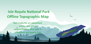
Isle Royale Offline Topo Map – Click to show
Isle Royale Offline Topo Map
XDivide Geospatial
Designed with simplicity in mind, this app offers an intuitive user interface that enables you to quickly and easily find information about surroundings, without any prior technical knowledge or expe…
$0.99
0.0
0+ downloads
|
Maps & Navigation
0.0
$0.99
XDivide Geospatial
0+ downloads
TRANSPORTATION
Isle Royale Offline Topo Map
Designed with simplicity in mind, this app offers an intuitive user interface that enables you to quickly and easily fi…
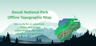
Denali Offline Topographic Map – Click to show
Denali Offline Topographic Map
XDivide Geospatial
Designed with simplicity in mind, this app offers an intuitive user interface that enables you to quickly and easily find information about surroundings, without any prior technical knowledge or expe…
$0.99
0.0
0+ downloads
|
Maps & Navigation
0.0
$0.99
XDivide Geospatial
0+ downloads
TRANSPORTATION
Denali Offline Topographic Map
Designed with simplicity in mind, this app offers an intuitive user interface that enables you to quickly and easily fi…
Agro Measure Map Pro
Blue Blink One, SL
Agro Measure Map Pro lets you quickly and easily measure multiple distances, perimeters and areas with laser sharp precision! It even takes into account the curvature of the earth’s surface. Us…
$94.99
4.2
500+ downloads
|
Maps & Navigation
4.2
$94.99
Blue Blink One, SL
500+ downloads
TRANSPORTATION
Agro Measure Map Pro
Agro Measure Map Pro lets you quickly and easily measure multiple distances, perimeters and areas with laser sharp prec…
United States
United Kingdom
Germany
Norway
Sweden
Australia
Netherlands
Italy
Denmark
Hong Kong
Brazil
France
Canada
Spain
Portugal
South Korea
Japan
Poland
Hungary
India
Finland
Thailand
Russia
General
Overall
Applications
Games
Join AppBrain
Join AppBrain to get app recommendations
Apps
Art & Design
Auto & Vehicles
Beauty
Books & Reference
Business
Comics
Communication
Dating
Education
Entertainment
Events
Finance
Food & Drink
Health & Fitness
House & Home
Libraries & Demo
Lifestyle
Maps & Navigation
Medical
Music & Audio
News & Magazines
Parenting
Personalization
Photography
Productivity
Shopping
Social
Sports
Tools
Travel & Local
Video Players & Editors
Weather
Games
Action
Adventure
Arcade
Board
Card
Casino
Casual
Educational
Music
Puzzle
Racing
Role Playing
Simulation
Sports Games
Strategy
Trivia
Word