

GPS Area & Camera
GPS Area & Camera is made and published by Vijayvir Singh. AppBrain is an independent app data site and isn't affiliated with Vijayvir Singh. The app name, icon, screenshots and description belong to Vijayvir Singh and are shown as published on the App Store.
AppBrain's verdict
- Last updated
- August 18, 2026
Rankings
App Store top chartsApp Store Rankings for GPS Area & Camera
Competitors
Similar apps and more from Vijayvir SinghAlternatives to GPS Area & Camera


More from Vijayvir Singh


Releases
Updates seen on the App Store- Version
- 1.0.21
- Launched
- July 2026
No changelog data
User feedback
Ratings and reviews on the App StoreComments on GPS Area & Camera for iOS
We don't have enough comments to show example comments. Please check back later.
Technology
Found in the app by AppBrain- Price
- Free
- App size
- 14.3 MB
- Content rating
- Everyone
Technologies used by GPS Area & Camera
About the app and developer
About GPS Area & Camera
GPS Area & Camera is an utilities app developed by Vijayvir Singh.
User Ratings
The app has no ratings yet.
App Information
GPS Area & Camera is freely available from the App Store. The app size is 14.25 MB. The latest version available is 1.0.21. The last update was on August 18, 2026.
Technical Requirements
The app has a content rating of Everyone. The app has been available on the App Store since July 2026.
Developer information for Vijayvir Singh
Address:
Store listing
By Vijayvir Singh, from the App Store




Description by Vijayvir Singh Written by the developer, not by AppBrain. Click to read.
Whether you are capturing evidence on a job site or walking the perimeter of an irregular agricultural plot, GPS Area & Camera gives you real-time data in a clean, fast interface.
GPS OVERLAY CAMERA
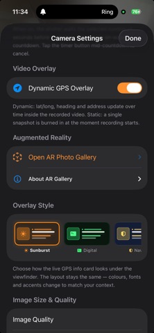
- Capture photos or 4K video with live metadata burned onto the frame
- Record front and rear lenses side by side on supported devices
- Show live latitude, longitude, altitude, compass heading, custom notes such as job site names or work orders, and an embedded mini map
- Drag, pinch to resize and reposition the overlay card live on screen
- Shoot clean photos now and bake the GPS card onto the media later using the preview editor
LAND AREA AND PERIMETER MEASUREMENT
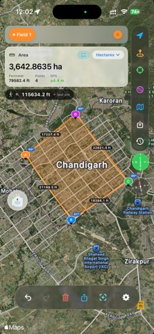
- Drop vertices by tapping the map, draw free-hand, or use Walk-Trace to plot points automatically from your live GPS path
- Switch between Acre, Hectare, Bigha, Marla, Kanal, Square Feet and Square Meters. Your selection is saved automatically
- Locate and mark the exact centroid of any plot with its lat-long coordinates
- Keep multiple measurements open at once and switch between them like browser tabs
MAPPING, HISTORY AND EXPORT
- Cycle between Standard, Satellite and Hybrid map views
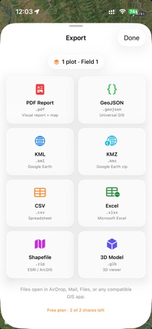
- Export professional layout reports as PDF, or raw polygon data as KML or GeoJSON for use in external GIS tools
- Review saved measurements, areas and perimeters with map thumbnails, sorted by day, week, month or location
AR PHOTO GALLERY
- Walk around your location and view geotagged photos floating in 3D space at the exact coordinates where they were taken
- Haptic and onscreen proximity alerts when you approach a cluster of geotagged media
PERFECT FOR
Agriculture and farming: measure acreage, check bounds and calculate fencing in Kanal, Marla or Bigha.
Civil engineering and construction: log site progress, verify coordinates and share geotagged visual evidence.
Real estate and insurance: capture verified location-stamped records and exact perimeter layouts.
SUBSCRIPTION
GPS Area & Camera offers an auto-renewing subscription:
- 1 Month: [price]
- 1 Year: [price]
Payment is charged to your Apple Account at confirmation of purchase. The subscription renews automatically unless it is cancelled at least 24 hours before the end of the current period. Your account is charged for renewal within 24 hours prior to the end of the current period. You can manage or cancel your subscription in Account Settings after purchase.
Terms of Use (EULA): https://www.apple.com/legal/internet-services/itunes/dev/stdeula/
Support: https://antfirelabs.com